Area Overview for SS15 5LA
Photos of SS15 5LA
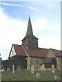
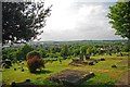
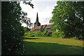
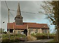
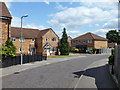
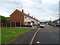
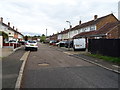
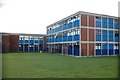
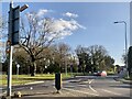
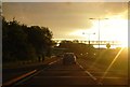
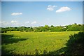
11 photos from this area
Area Information
Key information about the SS15 5LA including its size, population, and administrative classification.
- Area Type
- Postcode
- Area Size
- 5563 m²
- Population
- 1948
- Population Density
- 4429 people/km²
House Prices in SS15 5LA
20
Properties
£197,001
Average Sold Price
£53,500
Lowest Price
£330,000
Highest Price
Showing 20 properties
| Address | Type | Beds | Baths | Last Sale Price | Last Sale Date | |
|---|---|---|---|---|---|---|
| 53 The Frame, Laindon, Basildon, SS15 5LA | Terraced | 3 | 1 | £330,000 | May 2025 | |
| 37 The Frame, Laindon, Basildon, SS15 5LA | Terraced | 3 | 1 | £303,000 | Feb 2025 | |
| 27 The Frame, Laindon, Basildon, SS15 5LA | Terraced | 3 | 1 | £310,000 | Mar 2023 | |
| 35 The Frame, Laindon, Basildon, SS15 5LA | house | - | - | £235,000 | Mar 2022 | |
| 61 The Frame, Laindon, Basildon, SS15 5LA | house | - | - | £145,000 | Dec 2010 | |
| 45 The Frame, Laindon, Basildon, SS15 5LA | house | 3 | - | £117,505 | Nov 2010 | |
| 57 The Frame, Laindon, Basildon, SS15 5LA | house | - | - | £147,000 | Aug 2006 | |
| 29 The Frame, Laindon, Basildon, SS15 5LA | Terraced | - | - | £132,000 | Oct 2005 | |
| 51 The Frame, Laindon, Basildon, SS15 5LA | Terraced | - | - | £53,500 | Jun 1997 | |
| 33 The Frame, Laindon, Basildon, SS15 5LA | Terraced | - | - | - | - |
Page 1 of 2
Energy Efficiency in SS15 5LA
Amenities
Schools
| Rank | School | Type | Entry gender | Ages |
|---|
Explore more schools in this area
Go to Schools tabDemographics
Household Size
Family (3-5 people)
most common
Accommodation Type
Houses
most common
Tenure
49
majority
Ethnic Group
White
most common
Religion
N/A
most common
Household Composition
N/A
most common
Age
47
median
Adults (30-64 years)
most common
Household Deprivation
N/A
with no deprivation
NS-SEC
25
in Lower managerial occupations
Explore more demographic insights in this area
Go to Demographics tabPlanning
Planning Constraints
- Flood RiskPremium
- Ramsar Wetland SitesPremium
- Area of Outstanding Natural BeautyPremium
- Protected Nature ReservePremium
- Protected WoodlandPremium