Area Overview for SS14 2RF
Photos of SS14 2RF
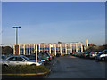
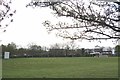
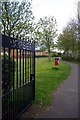
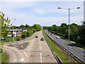
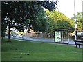
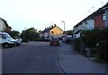
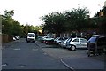

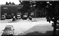
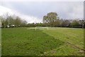
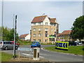
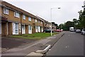
18 photos from this area
Area Information
Key information about the SS14 2RF including its size, population, and administrative classification.
- Area Type
- Postcode
- Area Size
- 5187 m²
- Population
- 2225
- Population Density
- 5647 people/km²
House Prices in SS14 2RF
23
Properties
£265,585
Average Sold Price
£40,000
Lowest Price
£1,544,019
Highest Price
Showing 23 properties
| Address | Type | Beds | Baths | Last Sale Price | Last Sale Date | |
|---|---|---|---|---|---|---|
| 36 Goldhanger Cross, Basildon, SS14 2RF | Flat | - | - | £115,000 | Mar 2023 | |
| 38 Goldhanger Cross, Basildon, SS14 2RF | Retail | 2 | 1 | £209,000 | Sep 2022 | |
| 49 Goldhanger Cross, Basildon, SS14 2RF | Terraced | 3 | 1 | £336,000 | Jul 2022 | |
| 41 Goldhanger Cross, Basildon, SS14 2RF | house | - | - | £1,544,019 | Jan 2021 | |
| 32 Goldhanger Cross, Basildon, SS14 2RF | Terraced | 2 | 1 | £243,500 | Jan 2020 | |
| 28 Goldhanger Cross, Basildon, SS14 2RF | Terraced | 2 | 1 | £205,000 | Oct 2015 | |
| 51 Goldhanger Cross, Basildon, SS14 2RF | Terraced | 3 | 2 | £140,000 | Feb 2014 | |
| 47 Goldhanger Cross, Basildon, SS14 2RF | house | 3 | - | £125,000 | Nov 2010 | |
| 43 Goldhanger Cross, Basildon, SS14 2RF | Terraced | - | - | £120,000 | Oct 2003 | |
| 45 Goldhanger Cross, Basildon, SS14 2RF | Terraced | - | - | £68,500 | Apr 2001 |
Page 1 of 3
Energy Efficiency in SS14 2RF
Amenities
Schools
| Rank | School | Type | Entry gender | Ages |
|---|
Explore more schools in this area
Go to Schools tabDemographics
Household Size
Family (3-5 people)
most common
Accommodation Type
Houses
most common
Tenure
52
majority
Ethnic Group
White
most common
Religion
N/A
most common
Household Composition
N/A
most common
Age
47
median
Adults (30-64 years)
most common
Household Deprivation
N/A
with no deprivation
NS-SEC
23
in Lower managerial occupations
Explore more demographic insights in this area
Go to Demographics tabPlanning
Planning Constraints
- Flood RiskPremium
- Ramsar Wetland SitesPremium
- Area of Outstanding Natural BeautyPremium
- Protected Nature ReservePremium
- Protected WoodlandPremium