Area Overview for SS14 1SD
Photos of SS14 1SD
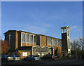
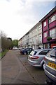
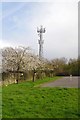
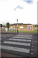


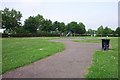
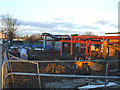
17 photos from this area
Area Information
Key information about the SS14 1SD including its size, population, and administrative classification.
- Area Type
- Postcode
- Area Size
- 1.6 hectares
- Population
- 1870
- Population Density
- 4830 people/km²
House Prices in SS14 1SD
36
Properties
£209,695
Average Sold Price
£59,950
Lowest Price
£376,000
Highest Price
Showing 36 properties
| Address | Type | Beds | Baths | Last Sale Price | Last Sale Date | |
|---|---|---|---|---|---|---|
| 75 Luncies Road, Basildon, SS14 1SD | Terraced | 3 | 1 | £376,000 | Jun 2025 | |
| 71 Luncies Road, Basildon, SS14 1SD | house | 3 | 1 | £365,500 | Dec 2022 | |
| 120 Luncies Road, Basildon, SS14 1SD | house | - | - | £180,400 | May 2022 | |
| 83 Luncies Road, Basildon, SS14 1SD | Retail | 3 | 1 | £335,000 | Apr 2022 | |
| 112 Luncies Road, Basildon, SS14 1SD | house | - | - | £250,000 | Feb 2022 | |
| 95 Luncies Road, Basildon, SS14 1SD | house | - | - | £155,000 | Oct 2017 | |
| 73 Luncies Road, Basildon, SS14 1SD | Terraced | 4 | - | £169,000 | May 2014 | |
| 110 Luncies Road, Basildon, SS14 1SD | Terraced | - | - | £171,995 | Dec 2006 | |
| 85 Luncies Road, Basildon, SS14 1SD | Terraced | - | - | £178,000 | Dec 2005 | |
| 97 Luncies Road, Basildon, SS14 1SD | house | - | - | £215,500 | Jul 2005 |
Page 1 of 4
Energy Efficiency in SS14 1SD
Amenities
Schools
| Rank | School | Type | Entry gender | Ages |
|---|
Explore more schools in this area
Go to Schools tabDemographics
Household Size
Family (3-5 people)
most common
Accommodation Type
Houses
most common
Tenure
56
majority
Ethnic Group
White
most common
Religion
N/A
most common
Household Composition
N/A
most common
Age
47
median
Adults (30-64 years)
most common
Household Deprivation
N/A
with no deprivation
NS-SEC
25
in Lower managerial occupations
Explore more demographic insights in this area
Go to Demographics tabPlanning
Planning Constraints
- Flood RiskPremium
- Ramsar Wetland SitesPremium
- Area of Outstanding Natural BeautyPremium
- Protected Nature ReservePremium
- Protected WoodlandPremium