Area Overview for SS14 1RS
Photos of SS14 1RS
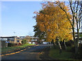
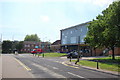
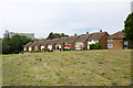
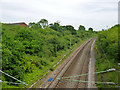
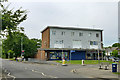
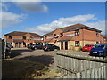
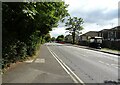
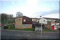
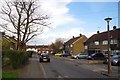
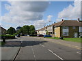
17 photos from this area
Area Information
Key information about the SS14 1RS including its size, population, and administrative classification.
- Area Type
- Postcode
- Area Size
- 5145 m²
- Population
- 1728
- Population Density
- 8064 people/km²
House Prices in SS14 1RS
38
Properties
£199,077
Average Sold Price
£103,000
Lowest Price
£325,000
Highest Price
Showing 38 properties
| Address | Type | Beds | Baths | Last Sale Price | Last Sale Date | |
|---|---|---|---|---|---|---|
| 242 Long Riding, Basildon, SS14 1RS | Terraced | 4 | 1 | £292,000 | Mar 2025 | |
| 254 Long Riding, Basildon, SS14 1RS | Terraced | 3 | 1 | £250,000 | Aug 2023 | |
| 272 Long Riding, Basildon, SS14 1RS | house | 3 | 1 | £325,000 | Nov 2022 | |
| 252 Long Riding, Basildon, SS14 1RS | Terraced | 3 | 1 | £214,000 | Sep 2019 | |
| 262 Long Riding, Basildon, SS14 1RS | Terraced | 3 | 1 | £210,000 | Aug 2018 | |
| 246 Long Riding, Basildon, SS14 1RS | Terraced | 4 | 1 | £225,000 | Dec 2017 | |
| 292 Long Riding, Basildon, SS14 1RS | Flat | - | - | £125,000 | Sep 2017 | |
| 248 Long Riding, Basildon, SS14 1RS | house | 3 | - | £225,000 | Jan 2017 | |
| 240 Long Riding, Basildon, SS14 1RS | Terraced | 4 | 1 | £220,000 | Jun 2016 | |
| 268 Long Riding, Basildon, SS14 1RS | house | - | - | £159,000 | Jul 2015 |
Page 1 of 4
Energy Efficiency in SS14 1RS
Amenities
Schools
| Rank | School | Type | Entry gender | Ages |
|---|
Explore more schools in this area
Go to Schools tabDemographics
Household Size
Family (3-5 people)
most common
Accommodation Type
Houses
most common
Tenure
47
majority
Ethnic Group
White
most common
Religion
N/A
most common
Household Composition
N/A
most common
Age
47
median
Adults (30-64 years)
most common
Household Deprivation
N/A
with no deprivation
NS-SEC
18
in Lower managerial occupations
Explore more demographic insights in this area
Go to Demographics tabPlanning
Planning Constraints
- Flood RiskPremium
- Ramsar Wetland SitesPremium
- Area of Outstanding Natural BeautyPremium
- Protected Nature ReservePremium
- Protected WoodlandPremium