Area Overview for SS14 1PW
Photos of SS14 1PW
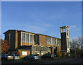
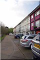
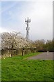
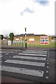


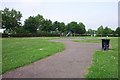
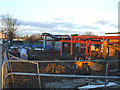
17 photos from this area
Area Information
Key information about the SS14 1PW including its size, population, and administrative classification.
- Area Type
- Postcode
- Area Size
- 2.5 hectares
- Population
- 1628
- Population Density
- 6032 people/km²
House Prices in SS14 1PW
38
Properties
£199,321
Average Sold Price
£33,000
Lowest Price
£470,000
Highest Price
Showing 38 properties
| Address | Type | Beds | Baths | Last Sale Price | Last Sale Date | |
|---|---|---|---|---|---|---|
| 39 Fairview Road, Basildon, SS14 1PW | house | - | - | £380,000 | Mar 2025 | |
| 41 Fairview Road, Basildon, SS14 1PW | Bungalow | 2 | 2 | £281,000 | Mar 2025 | |
| 3 Fairview Road, Basildon, SS14 1PW | Terraced | 2 | 1 | £307,500 | Feb 2023 | |
| 26 Fairview Road, Basildon, SS14 1PW | Retail | 2 | 1 | £470,000 | Feb 2022 | |
| 11 Fairview Road, Basildon, SS14 1PW | Bungalow | 2 | 2 | £320,000 | Nov 2019 | |
| 31 Fairview Road, Basildon, SS14 1PW | Chalet | 5 | 2 | £432,000 | Feb 2019 | |
| 1A Fairview Road, Basildon, SS14 1PW | house | - | - | £186,000 | Feb 2016 | |
| 24 Fairview Road, Basildon, SS14 1PW | Detached | - | - | £200,000 | Jan 2016 | |
| 37 Fairview Road, Basildon, SS14 1PW | Bungalow | 2 | - | £196,000 | May 2013 | |
| 33 Fairview Road, Basildon, SS14 1PW | Bungalow | 3 | - | £200,000 | Aug 2012 |
Page 1 of 4
Energy Efficiency in SS14 1PW
Amenities
Schools
| Rank | School | Type | Entry gender | Ages |
|---|
Explore more schools in this area
Go to Schools tabDemographics
Household Size
Family (3-5 people)
most common
Accommodation Type
Houses
most common
Tenure
48
majority
Ethnic Group
White
most common
Religion
N/A
most common
Household Composition
N/A
most common
Age
47
median
Adults (30-64 years)
most common
Household Deprivation
N/A
with no deprivation
NS-SEC
21
in Lower managerial occupations
Explore more demographic insights in this area
Go to Demographics tabPlanning
Planning Constraints
- Flood RiskPremium
- Ramsar Wetland SitesPremium
- Area of Outstanding Natural BeautyPremium
- Protected Nature ReservePremium
- Protected WoodlandPremium