Area Overview for SS13 3LR
Photos of SS13 3LR
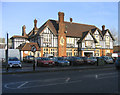
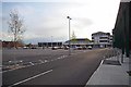
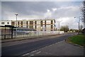

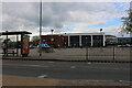
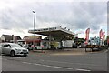
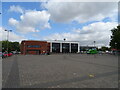
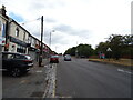
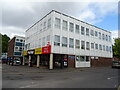
17 photos from this area
Area Information
Key information about the SS13 3LR including its size, population, and administrative classification.
- Area Type
- Postcode
- Area Size
- 7755 m²
- Population
- 1449
- Population Density
- 5212 people/km²
House Prices in SS13 3LR
35
Properties
£179,125
Average Sold Price
£24,504
Lowest Price
£308,000
Highest Price
Showing 35 properties
| Address | Type | Beds | Baths | Last Sale Price | Last Sale Date | |
|---|---|---|---|---|---|---|
| 136 Moretons, Pitsea, SS13 3LR | Terraced | 3 | 1 | £259,750 | Jan 2024 | |
| 94 Moretons, Pitsea, SS13 3LR | Terraced | 3 | 2 | £308,000 | Nov 2023 | |
| 86 Moretons, Pitsea, SS13 3LR | Terraced | 3 | 2 | £285,000 | Aug 2023 | |
| 84 Moretons, Pitsea, SS13 3LR | Terraced | 3 | 2 | £280,000 | Mar 2023 | |
| 88 Moretons, Pitsea, SS13 3LR | house | - | - | £270,000 | Nov 2021 | |
| 148 Moretons, Pitsea, SS13 3LR | Flat | - | - | £140,000 | Jul 2021 | |
| 130 Moretons, Pitsea, SS13 3LR | Terraced | 3 | 1 | £248,000 | May 2021 | |
| 122 Moretons, Pitsea, SS13 3LR | Terraced | 3 | 1 | £247,000 | Apr 2021 | |
| 80 Moretons, Pitsea, SS13 3LR | Terraced | 3 | 1 | £235,000 | Oct 2018 | |
| 114 Moretons, Pitsea, SS13 3LR | Terraced | 3 | 1 | £231,000 | Sep 2017 |
Page 1 of 4
Energy Efficiency in SS13 3LR
Amenities
Schools
| Rank | School | Type | Entry gender | Ages |
|---|
Explore more schools in this area
Go to Schools tabDemographics
Household Size
Family (3-5 people)
most common
Accommodation Type
Houses
most common
Tenure
44
majority
Ethnic Group
White
most common
Religion
N/A
most common
Household Composition
N/A
most common
Age
47
median
Adults (30-64 years)
most common
Household Deprivation
N/A
with no deprivation
NS-SEC
19
in Lower managerial occupations
Explore more demographic insights in this area
Go to Demographics tabPlanning
Planning Constraints
- Flood RiskPremium
- Ramsar Wetland SitesPremium
- Area of Outstanding Natural BeautyPremium
- Protected Nature ReservePremium
- Protected WoodlandPremium