Area Overview for SS13 3EJ
Photos of SS13 3EJ
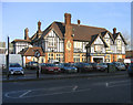
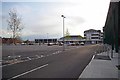
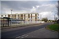

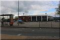
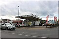
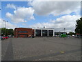
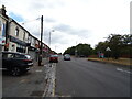
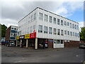
17 photos from this area
Area Information
Key information about the SS13 3EJ including its size, population, and administrative classification.
- Area Type
- Postcode
- Area Size
- 6275 m²
- Population
- 1649
- Population Density
- 8023 people/km²
House Prices in SS13 3EJ
26
Properties
£185,977
Average Sold Price
£19,720
Lowest Price
£315,000
Highest Price
Showing 26 properties
| Address | Type | Beds | Baths | Last Sale Price | Last Sale Date | |
|---|---|---|---|---|---|---|
| 23 Chevers Pawen, Pitsea, SS13 3EJ | Semi-detached | 3 | 1 | £305,000 | Aug 2023 | |
| 10 Chevers Pawen, Pitsea, SS13 3EJ | Terraced | 3 | 1 | £315,000 | Apr 2023 | |
| 11 Chevers Pawen, Pitsea, SS13 3EJ | house | - | - | £245,000 | Nov 2021 | |
| 2 Chevers Pawen, Pitsea, SS13 3EJ | Maisonette | 3 | 1 | £198,000 | Feb 2019 | |
| 15 Chevers Pawen, Pitsea, SS13 3EJ | house | 3 | - | £250,000 | Mar 2017 | |
| 8 Chevers Pawen, Pitsea, SS13 3EJ | Maisonette | - | - | £160,000 | Feb 2017 | |
| 26 Chevers Pawen, Pitsea, SS13 3EJ | house | - | - | £242,000 | Nov 2016 | |
| 21 Chevers Pawen, Pitsea, SS13 3EJ | house | - | - | £146,000 | Dec 2015 | |
| 3 Chevers Pawen, Pitsea, SS13 3EJ | Maisonette | 2 | 1 | £115,000 | Apr 2014 | |
| 25 Chevers Pawen, Pitsea, SS13 3EJ | house | 3 | - | £124,000 | Jun 2011 |
Page 1 of 3
Energy Efficiency in SS13 3EJ
Amenities
Schools
| Rank | School | Type | Entry gender | Ages |
|---|
Explore more schools in this area
Go to Schools tabDemographics
Household Size
Family (3-5 people)
most common
Accommodation Type
Houses
most common
Tenure
46
majority
Ethnic Group
White
most common
Religion
N/A
most common
Household Composition
N/A
most common
Age
47
median
Adults (30-64 years)
most common
Household Deprivation
N/A
with no deprivation
NS-SEC
20
in Lower managerial occupations
Explore more demographic insights in this area
Go to Demographics tabPlanning
Planning Constraints
- Flood RiskPremium
- Ramsar Wetland SitesPremium
- Area of Outstanding Natural BeautyPremium
- Protected Nature ReservePremium
- Protected WoodlandPremium