Area Overview for SS12 9QE
Photos of SS12 9QE
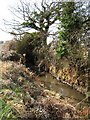
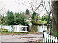
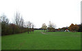
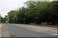
9 photos from this area
Area Information
Key information about the SS12 9QE including its size, population, and administrative classification.
- Area Type
- Postcode
- Area Size
- 9366 m²
- Population
- 2249
- Population Density
- 675 people/km²
House Prices in SS12 9QE
25
Properties
£143,562
Average Sold Price
£35,000
Lowest Price
£210,000
Highest Price
Showing 25 properties
| Address | Type | Beds | Baths | Last Sale Price | Last Sale Date | |
|---|---|---|---|---|---|---|
| 9, Cranfield Park Court, Radwinter Avenue, Wickford, SS12 9QE | Flat | 1 | 1 | £180,000 | May 2024 | |
| 21, Cranfield Park Court, Radwinter Avenue, Wickford, SS12 9QE | Flat | 1 | 1 | £210,000 | Sep 2022 | |
| 11, Cranfield Park Court, Radwinter Avenue, Wickford, SS12 9QE | Flat | - | - | £205,000 | Feb 2022 | |
| 22, Cranfield Park Court, Radwinter Avenue, Wickford, SS12 9QE | Flat | 1 | 1 | £180,000 | Apr 2021 | |
| 4, Cranfield Park Court, Radwinter Avenue, Wickford, SS12 9QE | Terraced | 2 | 1 | £197,000 | Sep 2020 | |
| 5, Cranfield Park Court, Radwinter Avenue, Wickford, SS12 9QE | Flat | - | - | £135,000 | Sep 2019 | |
| 25, Cranfield Park Court, Radwinter Avenue, Wickford, SS12 9QE | Maisonette | 1 | 1 | £150,000 | Aug 2019 | |
| 2, Cranfield Park Court, Radwinter Avenue, Wickford, SS12 9QE | Flat | - | - | £195,000 | Jul 2019 | |
| 6, Cranfield Park Court, Radwinter Avenue, Wickford, SS12 9QE | Flat | - | - | £138,000 | Apr 2019 | |
| 12, Cranfield Park Court, Radwinter Avenue, Wickford, SS12 9QE | Flat | 1 | 1 | £157,500 | Feb 2019 |
Page 1 of 3
Energy Efficiency in SS12 9QE
Amenities
Schools
| Rank | School | Type | Entry gender | Ages |
|---|
Explore more schools in this area
Go to Schools tabDemographics
Household Size
Family (3-5 people)
most common
Accommodation Type
Houses
most common
Tenure
76
majority
Ethnic Group
White
most common
Religion
N/A
most common
Household Composition
N/A
most common
Age
47
median
Adults (30-64 years)
most common
Household Deprivation
N/A
with no deprivation
NS-SEC
35
in Lower managerial occupations
Explore more demographic insights in this area
Go to Demographics tabPlanning
Planning Constraints
- Flood RiskPremium
- Ramsar Wetland SitesPremium
- Area of Outstanding Natural BeautyPremium
- Protected Nature ReservePremium
- Protected WoodlandPremium