Area Overview for SS12 9LA
Photos of SS12 9LA
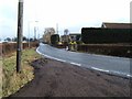
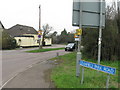
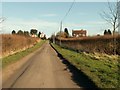

14 photos from this area
Area Information
Key information about the SS12 9LA including its size, population, and administrative classification.
- Area Type
- Postcode
- Area Size
- 17.9 hectares
- Population
- 1626
- Population Density
- 169 people/km²
House Prices in SS12 9LA
38
Properties
£202,250
Average Sold Price
£9,000
Lowest Price
£410,000
Highest Price
Showing 38 properties
| Address | Type | Beds | Baths | Last Sale Price | Last Sale Date | |
|---|---|---|---|---|---|---|
| Cranfield, Cranfield Park Avenue, North Benfleet, Basildon, SS12 9LA | Detached | 2 | 1 | £410,000 | Oct 2022 | |
| Mayfield, Cranfield Park Avenue, North Benfleet, Basildon, SS12 9LA | Detached | - | - | £40,000 | Nov 2019 | |
| Betterview, Cranfield Park Avenue, North Benfleet, Basildon, SS12 9LA | Mobile Home | - | - | £9,000 | Oct 2016 | |
| The Lodge, Cranfield Park Avenue, North Benfleet, Basildon, SS12 9LA | Bungalow | - | - | £350,000 | Feb 2013 | |
| Caravan 2, The Lodge, Cranfield Park Avenue, North Benfleet, Basildon, SS12 9LA | Mobile Home | - | - | - | - | |
| Caravan 1, The Lodge, Cranfield Park Avenue, North Benfleet, Basildon, SS12 9LA | Mobile Home | - | - | - | - | |
| Willow Farm, Cranfield Park Avenue, North Benfleet, Basildon, SS12 9LA | Mobile Home | - | - | - | - | |
| The Paddock, Cranfield Park Avenue, North Benfleet, Basildon, SS12 9LA | Detached | - | - | - | - | |
| Smallfield, Cranfield Park Avenue, North Benfleet, Basildon, SS12 9LA | Detached | - | - | - | - | |
| Bradley, Cranfield Park Avenue, North Benfleet, Basildon, SS12 9LA | Bungalow | - | - | - | - |
Page 1 of 4
Energy Efficiency in SS12 9LA
Amenities
Schools
| Rank | School | Type | Entry gender | Ages |
|---|
Explore more schools in this area
Go to Schools tabDemographics
Household Size
Family (3-5 people)
most common
Accommodation Type
Houses
most common
Tenure
82
majority
Ethnic Group
White
most common
Religion
N/A
most common
Household Composition
N/A
most common
Age
47
median
Adults (30-64 years)
most common
Household Deprivation
N/A
with no deprivation
NS-SEC
27
in Lower managerial occupations
Explore more demographic insights in this area
Go to Demographics tabPlanning
Planning Constraints
- Flood RiskPremium
- Ramsar Wetland SitesPremium
- Area of Outstanding Natural BeautyPremium
- Protected Nature ReservePremium
- Protected WoodlandPremium