Area Overview for SS12 9JF
Photos of SS12 9JF
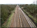

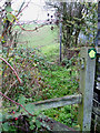
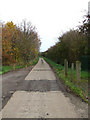
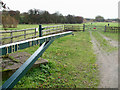
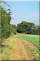
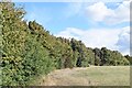
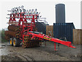
23 photos from this area
Area Information
Key information about the SS12 9JF including its size, population, and administrative classification.
- Area Type
- Postcode
- Area Size
- 1.3 km²
- Population
- 2249
- Population Density
- 675 people/km²
House Prices in SS12 9JF
25
Properties
£256,612
Average Sold Price
£185,000
Lowest Price
£400,000
Highest Price
Showing 25 properties
| Address | Type | Beds | Baths | Last Sale Price | Last Sale Date | |
|---|---|---|---|---|---|---|
| Morbec Lodge, Southend Arterial Road, Nevendon, Wickford, SS12 9JF | Detached | 4 | - | £400,000 | May 2020 | |
| Ivanhoe, Southend Arterial Road, Nevendon, Wickford, SS12 9JF | Semi-detached | 5 | 2 | £223,448 | Dec 2019 | |
| Fanton Lodge, Southend Arterial Road, Nevendon, Wickford, SS12 9JF | Detached | 4 | 2 | £218,000 | Oct 2000 | |
| Brookside, Southend Arterial Road, Nevendon, Wickford, SS12 9JF | Detached | - | - | £185,000 | Jan 1996 | |
| Morbec Farm, Southend Arterial Road, Nevendon, Wickford, SS12 9JF | Land | 3 | - | - | - | |
| Bersheda, Southend Arterial Road, Nevendon, Wickford, SS12 9JF | Bungalow | - | - | - | - | |
| Fanton Hall Farm House, Southend Arterial Road, Nevendon, Wickford, SS12 9JF | house | 5 | 2 | - | - | |
| The Bungalow, Fanton Hall Farm, Southend Arterial Road, Nevendon, Wickford, SS12 9JF | Bungalow | - | - | - | - | |
| Unicorn House, Southend Arterial Road, Nevendon, Wickford, SS12 9JF | Detached | - | - | - | - | |
| Brothers In Art Tattoo Company Limited, Barn 11, Fanton Hall Farm, Southend Arterial Road, Nevendon, Wickford, SS12 9JF | Office | - | - | - | - |
Page 1 of 3
Energy Efficiency in SS12 9JF
Amenities
Schools
| Rank | School | Type | Entry gender | Ages |
|---|
Explore more schools in this area
Go to Schools tabDemographics
Household Size
Family (3-5 people)
most common
Accommodation Type
Houses
most common
Tenure
76
majority
Ethnic Group
White
most common
Religion
N/A
most common
Household Composition
N/A
most common
Age
47
median
Adults (30-64 years)
most common
Household Deprivation
N/A
with no deprivation
NS-SEC
35
in Lower managerial occupations
Explore more demographic insights in this area
Go to Demographics tabPlanning
Planning Constraints
- Flood RiskPremium
- Ramsar Wetland SitesPremium
- Area of Outstanding Natural BeautyPremium
- Protected Nature ReservePremium
- Protected WoodlandPremium