Area Overview for SS11 8SY
Photos of SS11 8SY
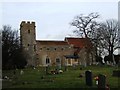
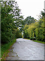
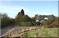
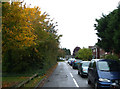
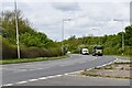

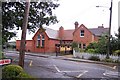
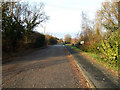
16 photos from this area
Area Information
Key information about the SS11 8SY including its size, population, and administrative classification.
- Area Type
- Postcode
- Area Size
- 41.0 hectares
- Population
- 2193
- Population Density
- 190 people/km²
House Prices in SS11 8SY
25
Properties
£248,333
Average Sold Price
£175,000
Lowest Price
£370,000
Highest Price
Showing 25 properties
| Address | Type | Beds | Baths | Last Sale Price | Last Sale Date | |
|---|---|---|---|---|---|---|
| Gwithian, Chelmsford Road, Rawreth, SS11 8SY | Bungalow | - | - | £370,000 | Jul 2017 | |
| High Acre, Chelmsford Road, Rawreth, SS11 8SY | Detached | - | - | £200,000 | Sep 2002 | |
| Primrose Cottage, Chelmsford Road, Rawreth, SS11 8SY | Detached | - | - | £175,000 | Jul 1998 | |
| Hambro House, Chelmsford Road, Rawreth, SS11 8SY | Detached | 4 | - | - | - | |
| Brywood House, Chelmsford Road, Rawreth, SS11 8SY | Semi-detached | - | - | - | - | |
| Otm Motors, Office At, Good Companions Garage, Chelmsford Road, Rawreth, SS11 8SY | Office | - | - | - | - | |
| Mobile Home At Newlands Nursery, Chelmsford Road, Rawreth, SS11 8SY | Mobile Home | - | - | - | - | |
| Acl Gp Limited, Unit 10A Rear Of, Clovelly, Chelmsford Road, Rawreth, SS11 8SY | Office | - | - | - | - | |
| Rkl Limited, Yard 13 Rear Of, Clovelly, Chelmsford Road, Rawreth, SS11 8SY | Industrial | - | - | - | - | |
| Tennis 50M From Garwood Lodge, Church Road 64M From Church Road, Church Road, Rawreth, SS11 8SY | Leisure | - | - | - | - |
Page 1 of 3
Energy Efficiency in SS11 8SY
Amenities
Schools
| Rank | School | Type | Entry gender | Ages |
|---|
Explore more schools in this area
Go to Schools tabDemographics
Household Size
Family (3-5 people)
most common
Accommodation Type
Houses
most common
Tenure
80
majority
Ethnic Group
White
most common
Religion
N/A
most common
Household Composition
N/A
most common
Age
47
median
Adults (30-64 years)
most common
Household Deprivation
N/A
with no deprivation
NS-SEC
40
in Lower managerial occupations
Explore more demographic insights in this area
Go to Demographics tabPlanning
Planning Constraints
- Flood RiskPremium
- Ramsar Wetland SitesPremium
- Area of Outstanding Natural BeautyPremium
- Protected Nature ReservePremium
- Protected WoodlandPremium