Area Overview for SS11 8NZ
Photos of SS11 8NZ


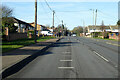
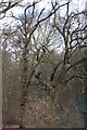
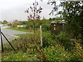
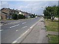
13 photos from this area
Area Information
Key information about the SS11 8NZ including its size, population, and administrative classification.
- Area Type
- Postcode
- Area Size
- 1.4 hectares
- Population
- 1675
- Population Density
- 4169 people/km²
House Prices in SS11 8NZ
53
Properties
£184,578
Average Sold Price
£24,155
Lowest Price
£390,000
Highest Price
Showing 53 properties
| Address | Type | Beds | Baths | Last Sale Price | Last Sale Date | |
|---|---|---|---|---|---|---|
| 73 Bridge Road, Wickford, SS11 8NZ | Flat | - | - | £180,000 | Feb 2024 | |
| 7 Bridge Road, Wickford, SS11 8NZ | Semi-detached | 3 | 1 | £390,000 | Nov 2023 | |
| 65 Bridge Road, Wickford, SS11 8NZ | Flat | - | - | £200,000 | Sep 2023 | |
| 109 Bridge Road, Wickford, SS11 8NZ | Flat | - | - | £235,000 | Jun 2023 | |
| 59 Bridge Road, Wickford, SS11 8NZ | Flat | 2 | 1 | £232,500 | Sep 2022 | |
| 69 Bridge Road, Wickford, SS11 8NZ | Flat | 1 | 1 | £192,500 | Aug 2022 | |
| 71 Bridge Road, Wickford, SS11 8NZ | Flat | 1 | 1 | £177,000 | Jun 2022 | |
| 81 Bridge Road, Wickford, SS11 8NZ | Flat | 2 | 2 | £248,000 | Apr 2022 | |
| 41 Bridge Road, Wickford, SS11 8NZ | house | - | - | £360,000 | Apr 2022 | |
| 107 Bridge Road, Wickford, SS11 8NZ | Flat | - | - | £225,000 | Oct 2021 |
Page 1 of 6
Energy Efficiency in SS11 8NZ
Amenities
Schools
| Rank | School | Type | Entry gender | Ages |
|---|
Explore more schools in this area
Go to Schools tabDemographics
Household Size
Family (3-5 people)
most common
Accommodation Type
Houses
most common
Tenure
88
majority
Ethnic Group
White
most common
Religion
N/A
most common
Household Composition
N/A
most common
Age
47
median
Adults (30-64 years)
most common
Household Deprivation
N/A
with no deprivation
NS-SEC
32
in Lower managerial occupations
Explore more demographic insights in this area
Go to Demographics tabPlanning
Planning Constraints
- Flood RiskPremium
- Ramsar Wetland SitesPremium
- Area of Outstanding Natural BeautyPremium
- Protected Nature ReservePremium
- Protected WoodlandPremium