Area Overview for SS11 8LP
Photos of SS11 8LP
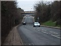
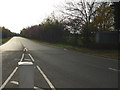
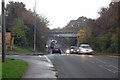
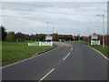
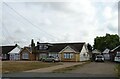
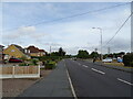
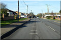
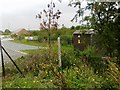
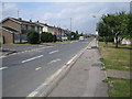
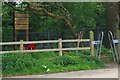
13 photos from this area
Area Information
Key information about the SS11 8LP including its size, population, and administrative classification.
- Area Type
- Postcode
- Area Size
- 1.1 hectares
- Population
- 1496
- Population Density
- 2923 people/km²
House Prices in SS11 8LP
16
Properties
£337,722
Average Sold Price
£172,500
Lowest Price
£560,000
Highest Price
Showing 16 properties
| Address | Type | Beds | Baths | Last Sale Price | Last Sale Date | |
|---|---|---|---|---|---|---|
| 109 Hill Avenue, Wickford, SS11 8LP | house | 4 | 1 | £345,000 | Jun 2024 | |
| 111 Hill Avenue, Wickford, SS11 8LP | Terraced | 3 | 1 | £340,000 | Sep 2021 | |
| 117 Hill Avenue, Wickford, SS11 8LP | Terraced | 3 | 1 | £320,000 | Jun 2021 | |
| 101 Hill Avenue, Wickford, SS11 8LP | house | - | - | £405,000 | Aug 2019 | |
| 97 Hill Avenue, Wickford, SS11 8LP | Semi-detached | 4 | - | £342,000 | Dec 2018 | |
| 105 Hill Avenue, Wickford, SS11 8LP | Detached | 4 | 3 | £560,000 | Aug 2017 | |
| 103 Hill Avenue, Wickford, SS11 8LP | Bungalow | 2 | - | £335,000 | Dec 2013 | |
| 113 Hill Avenue, Wickford, SS11 8LP | house | - | - | £220,000 | Jan 2013 | |
| 93 Hill Avenue, Wickford, SS11 8LP | Detached | 4 | - | £172,500 | Jan 2009 | |
| 62A Hill Avenue, Wickford, SS11 8LP | Detached | - | - | - | - |
Page 1 of 2
Energy Efficiency in SS11 8LP
Amenities
Schools
| Rank | School | Type | Entry gender | Ages |
|---|
Explore more schools in this area
Go to Schools tabDemographics
Household Size
Two person
most common
Accommodation Type
Houses
most common
Tenure
88
majority
Ethnic Group
White
most common
Religion
N/A
most common
Household Composition
N/A
most common
Age
47
median
Adults (30-64 years)
most common
Household Deprivation
N/A
with no deprivation
NS-SEC
32
in Lower managerial occupations
Explore more demographic insights in this area
Go to Demographics tabPlanning
Planning Constraints
- Flood RiskPremium
- Ramsar Wetland SitesPremium
- Area of Outstanding Natural BeautyPremium
- Protected Nature ReservePremium
- Protected WoodlandPremium