Area Overview for SS11 8FX
Photos of SS11 8FX
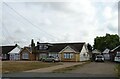
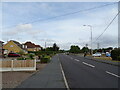
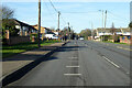
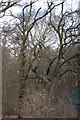
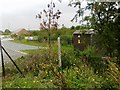
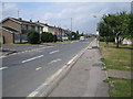
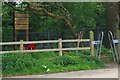
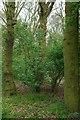
13 photos from this area
Area Information
Key information about the SS11 8FX including its size, population, and administrative classification.
- Area Type
- Postcode
- Area Size
- 1.2 hectares
- Population
- 1810
- Population Density
- 1457 people/km²
House Prices in SS11 8FX
35
Properties
£239,154
Average Sold Price
£100,495
Lowest Price
£410,000
Highest Price
Showing 35 properties
| Address | Type | Beds | Baths | Last Sale Price | Last Sale Date | |
|---|---|---|---|---|---|---|
| 20 Hawkins Close, Wickford, SS11 8FX | Semi-detached | 3 | 2 | £410,000 | Sep 2025 | |
| 11 Hawkins Close, Wickford, SS11 8FX | Terraced | 2 | 1 | £307,500 | Sep 2024 | |
| 2 Hawkins Close, Wickford, SS11 8FX | Semi-detached | 3 | 2 | £400,000 | Jul 2024 | |
| 5 Hawkins Close, Wickford, SS11 8FX | Semi-detached | 3 | 2 | £366,000 | Jun 2024 | |
| 26 Hawkins Close, Wickford, SS11 8FX | Semi-detached | 2 | 2 | £335,000 | Aug 2023 | |
| 40 Hawkins Close, Wickford, SS11 8FX | Semi-detached | 3 | 2 | £390,000 | Jul 2023 | |
| 6 Hawkins Close, Wickford, SS11 8FX | house | 2 | 1 | £325,000 | Jul 2023 | |
| 16 Hawkins Close, Wickford, SS11 8FX | Semi-detached | 3 | 2 | £330,000 | Apr 2020 | |
| 42 Hawkins Close, Wickford, SS11 8FX | Semi-detached | 3 | 2 | £315,000 | Oct 2019 | |
| 38 Hawkins Close, Wickford, SS11 8FX | Semi-detached | 4 | 1 | £320,000 | Mar 2019 |
Page 1 of 4
Energy Efficiency in SS11 8FX
Amenities
Schools
| Rank | School | Type | Entry gender | Ages |
|---|
Explore more schools in this area
Go to Schools tabDemographics
Household Size
Family (3-5 people)
most common
Accommodation Type
Houses
most common
Tenure
82
majority
Ethnic Group
White
most common
Religion
N/A
most common
Household Composition
N/A
most common
Age
47
median
Adults (30-64 years)
most common
Household Deprivation
N/A
with no deprivation
NS-SEC
32
in Lower managerial occupations
Explore more demographic insights in this area
Go to Demographics tabPlanning
Planning Constraints
- Flood RiskPremium
- Ramsar Wetland SitesPremium
- Area of Outstanding Natural BeautyPremium
- Protected Nature ReservePremium
- Protected WoodlandPremium