Area Overview for SS11 7GD
Photos of SS11 7GD
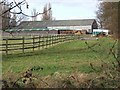
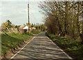
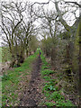
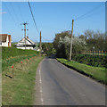
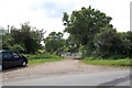
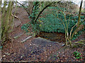
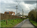
7 photos from this area
Area Information
Key information about the SS11 7GD including its size, population, and administrative classification.
- Area Type
- Postcode
- Area Size
- 3.8 hectares
- Population
- 1651
- Population Density
- 356 people/km²
House Prices in SS11 7GD
73
Properties
£563,935
Average Sold Price
£315,000
Lowest Price
£925,000
Highest Price
Showing 73 properties
| Address | Type | Beds | Baths | Last Sale Price | Last Sale Date | |
|---|---|---|---|---|---|---|
| 8 Running Well, Runwell, Wickford, SS11 7GD | Detached | 5 | 4 | £925,000 | Nov 2025 | |
| 9 Running Well, Runwell, Wickford, SS11 7GD | Terraced | 2 | 2 | £375,000 | Mar 2025 | |
| 76 Running Well, Runwell, Wickford, SS11 7GD | Semi-detached | 4 | 1 | £500,000 | Sep 2024 | |
| 74 Running Well, Runwell, Wickford, SS11 7GD | Semi-detached | 4 | 3 | £530,000 | Sep 2023 | |
| 13 Running Well, Runwell, Wickford, SS11 7GD | Terraced | 3 | 1 | £430,000 | May 2023 | |
| 29 Running Well, Runwell, Wickford, SS11 7GD | Detached | 3 | 2 | £522,500 | Feb 2023 | |
| 14 Running Well, Runwell, Wickford, SS11 7GD | Detached | 6 | 3 | £700,000 | Dec 2022 | |
| 30 Running Well, Runwell, Wickford, SS11 7GD | Retail | 4 | 2 | £620,000 | Oct 2022 | |
| 7 Running Well, Runwell, Wickford, SS11 7GD | Terraced | 2 | 1 | £395,000 | Oct 2022 | |
| 72 Running Well, Runwell, Wickford, SS11 7GD | house | - | - | £700,000 | Jan 2022 |
Page 1 of 8
Energy Efficiency in SS11 7GD
Amenities
Schools
| Rank | School | Type | Entry gender | Ages |
|---|
Explore more schools in this area
Go to Schools tabDemographics
Household Size
Family (3-5 people)
most common
Accommodation Type
Houses
most common
Tenure
71
majority
Ethnic Group
White
most common
Religion
N/A
most common
Household Composition
N/A
most common
Age
47
median
Adults (30-64 years)
most common
Household Deprivation
N/A
with no deprivation
NS-SEC
38
in Lower managerial occupations
Explore more demographic insights in this area
Go to Demographics tabPlanning
Planning Constraints
- Flood RiskPremium
- Ramsar Wetland SitesPremium
- Area of Outstanding Natural BeautyPremium
- Protected Nature ReservePremium
- Protected WoodlandPremium