Area Overview for SS11 7DP
Photos of SS11 7DP
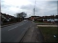
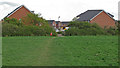
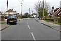
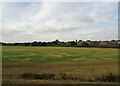
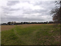
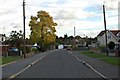
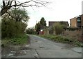
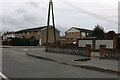
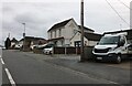
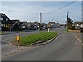
10 photos from this area
Area Information
Key information about the SS11 7DP including its size, population, and administrative classification.
- Area Type
- Postcode
- Area Size
- 6.3 hectares
- Population
- 1837
- Population Density
- 340 people/km²
House Prices in SS11 7DP
44
Properties
£296,613
Average Sold Price
£40,000
Lowest Price
£655,000
Highest Price
Showing 44 properties
| Address | Type | Beds | Baths | Last Sale Price | Last Sale Date | |
|---|---|---|---|---|---|---|
| 104 Church End Lane, Runwell, Wickford, SS11 7DP | Semi-detached | 3 | 1 | £327,000 | May 2024 | |
| 79 Church End Lane, Runwell, Wickford, SS11 7DP | Bungalow | 3 | 1 | £655,000 | Sep 2023 | |
| 122 Church End Lane, Runwell, Wickford, SS11 7DP | Bungalow | 3 | 1 | £530,000 | Sep 2023 | |
| 110 Church End Lane, Runwell, Wickford, SS11 7DP | Semi-detached | 2 | - | £305,000 | Jul 2023 | |
| 69 Church End Lane, Runwell, Wickford, SS11 7DP | Bungalow | 2 | 1 | £390,000 | Mar 2023 | |
| 114 Church End Lane, Runwell, Wickford, SS11 7DP | Bungalow | 3 | 1 | £520,000 | Apr 2021 | |
| 126 Church End Lane, Runwell, Wickford, SS11 7DP | house | - | - | £555,000 | Mar 2021 | |
| 59 Church End Lane, Runwell, Wickford, SS11 7DP | Bungalow | - | - | £318,000 | Jan 2021 | |
| 89 Church End Lane, Runwell, Wickford, SS11 7DP | Detached | 4 | 2 | £590,000 | Oct 2019 | |
| 100 Church End Lane, Runwell, Wickford, SS11 7DP | Semi-detached | 2 | 1 | £313,000 | Sep 2019 |
Page 1 of 5
Energy Efficiency in SS11 7DP
Amenities
Schools
| Rank | School | Type | Entry gender | Ages |
|---|
Explore more schools in this area
Go to Schools tabDemographics
Household Size
Two person
most common
Accommodation Type
Houses
most common
Tenure
90
majority
Ethnic Group
White
most common
Religion
N/A
most common
Household Composition
N/A
most common
Age
47
median
Adults (30-64 years)
most common
Household Deprivation
N/A
with no deprivation
NS-SEC
35
in Lower managerial occupations
Explore more demographic insights in this area
Go to Demographics tabPlanning
Planning Constraints
- Flood RiskPremium
- Ramsar Wetland SitesPremium
- Area of Outstanding Natural BeautyPremium
- Protected Nature ReservePremium
- Protected WoodlandPremium