Area Overview for SS1 3JB
Photos of SS1 3JB
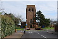

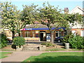
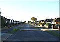
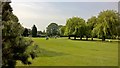
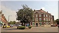
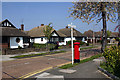
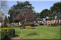
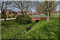
48 photos from this area
Area Information
Key information about the SS1 3JB including its size, population, and administrative classification.
- Area Type
- Postcode
- Area Size
- 1.6 hectares
- Population
- 1501
- Population Density
- 2251 people/km²
House Prices in SS1 3JB
22
Properties
£751,850
Average Sold Price
£197,500
Lowest Price
£2,000,000
Highest Price
Showing 22 properties
| Address | Type | Beds | Baths | Last Sale Price | Last Sale Date | |
|---|---|---|---|---|---|---|
| 104 Parkanaur Avenue, Thorpe Bay, SS1 3JB | Detached | 4 | 2 | £850,000 | Mar 2025 | |
| 100 Parkanaur Avenue, Thorpe Bay, SS1 3JB | Detached | 4 | 2 | £810,000 | Oct 2023 | |
| 92 Parkanaur Avenue, Thorpe Bay, SS1 3JB | Detached | 4 | 3 | £1,150,000 | Aug 2023 | |
| 88 Parkanaur Avenue, Thorpe Bay, SS1 3JB | Detached | 4 | 1 | £900,000 | Jan 2023 | |
| 94 Parkanaur Avenue, Thorpe Bay, SS1 3JB | house | 5 | - | £2,000,000 | Nov 2022 | |
| 72 Parkanaur Avenue, Thorpe Bay, SS1 3JB | Detached | 6 | 2 | £930,000 | Jun 2021 | |
| 74 Parkanaur Avenue, Thorpe Bay, SS1 3JB | house | - | - | £900,000 | Feb 2021 | |
| 82 Parkanaur Avenue, Thorpe Bay, SS1 3JB | Detached | 5 | - | £1,185,000 | Feb 2021 | |
| 80 Parkanaur Avenue, Thorpe Bay, SS1 3JB | Detached | 3 | 1 | £620,000 | Oct 2019 | |
| 64 Parkanaur Avenue, Thorpe Bay, SS1 3JB | Detached | 4 | 1 | £764,999 | Aug 2019 |
Page 1 of 3
Energy Efficiency in SS1 3JB
Amenities
Schools
| Rank | School | Type | Entry gender | Ages |
|---|
Explore more schools in this area
Go to Schools tabDemographics
Household Size
Two person
most common
Accommodation Type
Houses
most common
Tenure
92
majority
Ethnic Group
White
most common
Religion
N/A
most common
Household Composition
N/A
most common
Age
70
median
Elderly (65+ years)
most common
Household Deprivation
N/A
with no deprivation
NS-SEC
45
in Lower managerial occupations
Explore more demographic insights in this area
Go to Demographics tabPlanning
Planning Constraints
- Flood RiskPremium
- Ramsar Wetland SitesPremium
- Area of Outstanding Natural BeautyPremium
- Protected Nature ReservePremium
- Protected WoodlandPremium