Area Overview for SS1 3AR
Photos of SS1 3AR
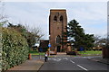

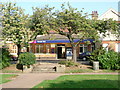
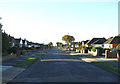
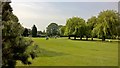

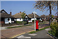
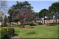
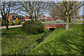
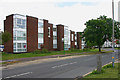


48 photos from this area
Area Information
Key information about the SS1 3AR including its size, population, and administrative classification.
- Area Type
- Postcode
- Area Size
- 1.3 hectares
- Population
- 1534
- Population Density
- 2640 people/km²
House Prices in SS1 3AR
18
Properties
£526,130
Average Sold Price
£149,950
Lowest Price
£1,510,000
Highest Price
Showing 18 properties
| Address | Type | Beds | Baths | Last Sale Price | Last Sale Date | |
|---|---|---|---|---|---|---|
| 168 Thorpe Hall Avenue, Thorpe Bay, SS1 3AR | Maisonette | 2 | 2 | £380,000 | Mar 2024 | |
| 166 Thorpe Hall Avenue, Thorpe Bay, SS1 3AR | Bungalow | 4 | 2 | £600,000 | Mar 2021 | |
| 178 Thorpe Hall Avenue, Thorpe Bay, SS1 3AR | Terraced | 5 | 2 | £422,500 | Jan 2021 | |
| 132 Thorpe Hall Avenue, Thorpe Bay, SS1 3AR | Detached | 7 | 4 | £1,510,000 | Jun 2020 | |
| 176 Thorpe Hall Avenue, Thorpe Bay, SS1 3AR | Flat | 2 | 2 | £330,000 | Mar 2019 | |
| 158 Thorpe Hall Avenue, Thorpe Bay, SS1 3AR | Detached | 5 | 3 | £950,000 | Mar 2019 | |
| 170 Thorpe Hall Avenue, Thorpe Bay, SS1 3AR | Maisonette | - | - | £380,000 | Mar 2018 | |
| 174 Thorpe Hall Avenue, Thorpe Bay, SS1 3AR | Maisonette | - | - | £420,000 | Jul 2017 | |
| 172 Thorpe Hall Avenue, Thorpe Bay, SS1 3AR | Maisonette | - | - | £380,000 | Jun 2017 | |
| 138 Thorpe Hall Avenue, Thorpe Bay, SS1 3AR | house | - | - | £540,000 | Dec 2015 |
Page 1 of 2
Energy Efficiency in SS1 3AR
Amenities
Schools
| Rank | School | Type | Entry gender | Ages |
|---|
Explore more schools in this area
Go to Schools tabDemographics
Household Size
Two person
most common
Accommodation Type
Houses
most common
Tenure
82
majority
Ethnic Group
White
most common
Religion
N/A
most common
Household Composition
N/A
most common
Age
47
median
Adults (30-64 years)
most common
Household Deprivation
N/A
with no deprivation
NS-SEC
47
in Lower managerial occupations
Explore more demographic insights in this area
Go to Demographics tabPlanning
Planning Constraints
- Flood RiskPremium
- Ramsar Wetland SitesPremium
- Area of Outstanding Natural BeautyPremium
- Protected Nature ReservePremium
- Protected WoodlandPremium