Area Overview for SS1 2TF
Photos of SS1 2TF

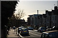
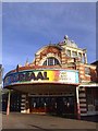
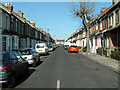
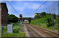
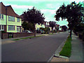
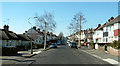
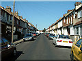
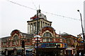
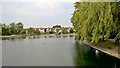
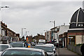
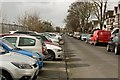
91 photos from this area
Area Information
Key information about the SS1 2TF including its size, population, and administrative classification.
- Area Type
- Postcode
- Area Size
- 1.8 hectares
- Population
- 2570
- Population Density
- 8224 people/km²
House Prices in SS1 2TF
79
Properties
£200,989
Average Sold Price
£17,674
Lowest Price
£480,000
Highest Price
Showing 79 properties
| Address | Type | Beds | Baths | Last Sale Price | Last Sale Date | |
|---|---|---|---|---|---|---|
| 105 Victoria Road, Southend On Sea, SS1 2TF | Terraced | 4 | 1 | £480,000 | Aug 2025 | |
| 94 Victoria Road, Southend On Sea, SS1 2TF | Terraced | 3 | 1 | £400,000 | Mar 2025 | |
| 55 Victoria Road, Southend On Sea, SS1 2TF | Flat | 1 | 1 | £184,250 | Mar 2025 | |
| 75 Victoria Road, Southend On Sea, SS1 2TF | Terraced | 4 | 2 | £370,000 | Dec 2024 | |
| 63A Victoria Road, Southend On Sea, SS1 2TF | Flat | - | - | £190,000 | May 2024 | |
| 67 Victoria Road, Southend On Sea, SS1 2TF | Terraced | - | - | £18,000 | Nov 2023 | |
| 87 Victoria Road, Southend On Sea, SS1 2TF | Terraced | - | - | £405,000 | May 2023 | |
| 113 Victoria Road, Southend On Sea, SS1 2TF | house | 3 | 1 | £425,000 | Nov 2022 | |
| 51 Victoria Road, Southend On Sea, SS1 2TF | Flat | 2 | 1 | £255,000 | May 2022 | |
| 107 Victoria Road, Southend On Sea, SS1 2TF | Bungalow | 1 | 1 | £260,000 | Mar 2022 |
Page 1 of 8
Energy Efficiency in SS1 2TF
Amenities
Schools
| Rank | School | Type | Entry gender | Ages |
|---|
Explore more schools in this area
Go to Schools tabDemographics
Household Size
One person
most common
Accommodation Type
Flats
most common
Tenure
31
majority
Ethnic Group
White
most common
Religion
N/A
most common
Household Composition
N/A
most common
Age
47
median
Adults (30-64 years)
most common
Household Deprivation
N/A
with no deprivation
NS-SEC
22
in Lower managerial occupations
Explore more demographic insights in this area
Go to Demographics tabPlanning
Planning Constraints
- Flood RiskPremium
- Ramsar Wetland SitesPremium
- Area of Outstanding Natural BeautyPremium
- Protected Nature ReservePremium
- Protected WoodlandPremium