Area Overview for SS1 1DW
Photos of SS1 1DW

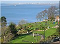
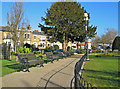
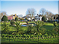

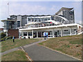
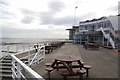

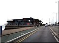
100 photos from this area
Area Information
Key information about the SS1 1DW including its size, population, and administrative classification.
- Area Type
- Postcode
- Area Size
- 7849 m²
- Population
- 1828
- Population Density
- 8566 people/km²
House Prices in SS1 1DW
27
Properties
£424,666
Average Sold Price
£60,000
Lowest Price
£850,000
Highest Price
Showing 27 properties
| Address | Type | Beds | Baths | Last Sale Price | Last Sale Date | |
|---|---|---|---|---|---|---|
| 9B Prittlewell Square, Southend On Sea, SS1 1DW | Flat | - | - | £280,000 | Jun 2024 | |
| 4 Prittlewell Square, Southend On Sea, SS1 1DW | Terraced | 5 | 2 | £850,000 | Dec 2021 | |
| 13 Prittlewell Square, Southend On Sea, SS1 1DW | Flat | - | - | £380,000 | Nov 2021 | |
| 14 Prittlewell Square, Southend On Sea, SS1 1DW | Flat | - | - | £160,000 | Dec 2020 | |
| 10 Prittlewell Square, Southend On Sea, SS1 1DW | house | - | - | £785,000 | Oct 2019 | |
| 3 Prittlewell Square, Southend On Sea, SS1 1DW | Detached | 5 | 3 | £720,000 | Sep 2014 | |
| 6 Prittlewell Square, Southend On Sea, SS1 1DW | Terraced | - | - | £645,000 | Jun 2014 | |
| 1 Prittlewell Square, Southend On Sea, SS1 1DW | Terraced | - | - | £445,000 | Dec 2006 | |
| 9C Prittlewell Square, Southend On Sea, SS1 1DW | Flat | 2 | 1 | £159,000 | Sep 2006 | |
| 12 Prittlewell Square, Southend On Sea, SS1 1DW | Terraced | - | - | £479,995 | Feb 2005 |
Page 1 of 3
Energy Efficiency in SS1 1DW
Amenities
Schools
| Rank | School | Type | Entry gender | Ages |
|---|
Explore more schools in this area
Go to Schools tabDemographics
Household Size
One person
most common
Accommodation Type
Flats
most common
Tenure
49
majority
Ethnic Group
White
most common
Religion
N/A
most common
Household Composition
N/A
most common
Age
47
median
Adults (30-64 years)
most common
Household Deprivation
N/A
with no deprivation
NS-SEC
38
in Lower managerial occupations
Explore more demographic insights in this area
Go to Demographics tabPlanning
Planning Constraints
- Flood RiskPremium
- Ramsar Wetland SitesPremium
- Area of Outstanding Natural BeautyPremium
- Protected Nature ReservePremium
- Protected WoodlandPremium