Area Overview for SS0 9JQ
Photos of SS0 9JQ
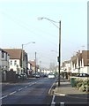
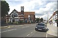
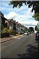
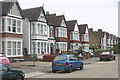
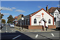
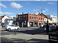
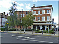
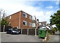
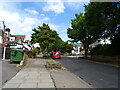
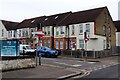
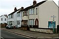

26 photos from this area
Area Information
Key information about the SS0 9JQ including its size, population, and administrative classification.
- Area Type
- Postcode
- Area Size
- 4096 m²
- Population
- 1665
- Population Density
- 12407 people/km²
House Prices in SS0 9JQ
19
Properties
£213,545
Average Sold Price
£54,995
Lowest Price
£385,000
Highest Price
Showing 19 properties
| Address | Type | Beds | Baths | Last Sale Price | Last Sale Date | |
|---|---|---|---|---|---|---|
| 88 Westborough Road, Westcliff On Sea, SS0 9JQ | Terraced | 3 | 1 | £385,000 | May 2025 | |
| 115 Westborough Road, Westcliff On Sea, SS0 9JQ | house | - | - | £279,000 | Jun 2020 | |
| 86 Westborough Road, Westcliff On Sea, SS0 9JQ | Terraced | 5 | 2 | £350,000 | Mar 2020 | |
| 90 Westborough Road, Westcliff On Sea, SS0 9JQ | Terraced | 3 | 1 | £287,000 | Feb 2020 | |
| 117 Westborough Road, Westcliff On Sea, SS0 9JQ | Terraced | 3 | 1 | £260,000 | May 2018 | |
| 113 Westborough Road, Westcliff On Sea, SS0 9JQ | Terraced | 3 | 1 | £195,000 | Feb 2014 | |
| 109 Westborough Road, Westcliff On Sea, SS0 9JQ | Terraced | 3 | 1 | £165,000 | Jul 2012 | |
| 102 Westborough Road, Westcliff On Sea, SS0 9JQ | Terraced | - | - | £157,000 | Dec 2005 | |
| 111 Westborough Road, Westcliff On Sea, SS0 9JQ | house | 3 | - | £142,000 | Dec 2003 | |
| 96 Westborough Road, Westcliff On Sea, SS0 9JQ | Semi-detached | 3 | 1 | £74,000 | Jun 2000 |
Page 1 of 2
Energy Efficiency in SS0 9JQ
Amenities
Schools
| Rank | School | Type | Entry gender | Ages |
|---|
Explore more schools in this area
Go to Schools tabDemographics
Household Size
One person
most common
Accommodation Type
Flats
most common
Tenure
47
majority
Ethnic Group
White
most common
Religion
N/A
most common
Household Composition
N/A
most common
Age
47
median
Adults (30-64 years)
most common
Household Deprivation
N/A
with no deprivation
NS-SEC
29
in Lower managerial occupations
Explore more demographic insights in this area
Go to Demographics tabPlanning
Planning Constraints
- Flood RiskPremium
- Ramsar Wetland SitesPremium
- Area of Outstanding Natural BeautyPremium
- Protected Nature ReservePremium
- Protected WoodlandPremium