Area Overview for SS0 8NQ
Photos of SS0 8NQ
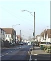
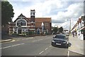
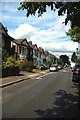
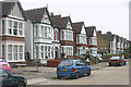


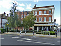
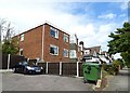
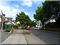
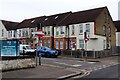
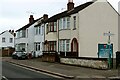

26 photos from this area
Area Information
Key information about the SS0 8NQ including its size, population, and administrative classification.
- Area Type
- Postcode
- Area Size
- 2.5 hectares
- Population
- 1616
- Population Density
- 4480 people/km²
House Prices in SS0 8NQ
52
Properties
£740,714
Average Sold Price
£180,000
Lowest Price
£1,500,000
Highest Price
Showing 52 properties
| Address | Type | Beds | Baths | Last Sale Price | Last Sale Date | |
|---|---|---|---|---|---|---|
| 42 Imperial Avenue, Westcliff On Sea, SS0 8NQ | house | - | - | £950,000 | Oct 2019 | |
| 40 Imperial Avenue, Westcliff On Sea, SS0 8NQ | Detached | 5 | 3 | £985,000 | Mar 2018 | |
| 44 Imperial Avenue, Westcliff On Sea, SS0 8NQ | Detached | 5 | 4 | £1,500,000 | Mar 2017 | |
| 41 Imperial Avenue, Westcliff On Sea, SS0 8NQ | Semi-detached | 5 | 2 | £550,000 | Nov 2013 | |
| 49 Imperial Avenue, Westcliff On Sea, SS0 8NQ | Detached | 4 | 1 | £499,999 | Aug 2012 | |
| 58 Imperial Avenue, Westcliff On Sea, SS0 8NQ | Detached | - | - | £520,000 | Oct 2006 | |
| 63 Imperial Avenue, Westcliff On Sea, SS0 8NQ | Detached | - | - | £180,000 | Feb 1995 | |
| Flat 6, Osbourne House, 57 Imperial Avenue, Westcliff On Sea, SS0 8NQ | Flat | 2 | 2 | - | - | |
| Flat 16, Osbourne House, 57 Imperial Avenue, Westcliff On Sea, SS0 8NQ | Flat | 2 | 2 | - | - | |
| Flat 3, 47 Imperial Avenue, Westcliff On Sea, SS0 8NQ | Flat | 2 | 1 | - | - |
Page 1 of 6
Energy Efficiency in SS0 8NQ
Amenities
Schools
| Rank | School | Type | Entry gender | Ages |
|---|
Explore more schools in this area
Go to Schools tabDemographics
Household Size
One person
most common
Accommodation Type
Flats
most common
Tenure
65
majority
Ethnic Group
White
most common
Religion
N/A
most common
Household Composition
N/A
most common
Age
47
median
Adults (30-64 years)
most common
Household Deprivation
N/A
with no deprivation
NS-SEC
38
in Lower managerial occupations
Explore more demographic insights in this area
Go to Demographics tabPlanning
Planning Constraints
- Flood RiskPremium
- Ramsar Wetland SitesPremium
- Area of Outstanding Natural BeautyPremium
- Protected Nature ReservePremium
- Protected WoodlandPremium