Area Overview for SS0 8AT
Photos of SS0 8AT
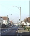
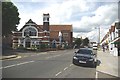
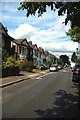
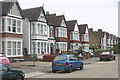
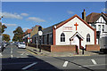
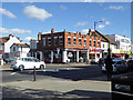
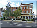
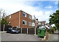
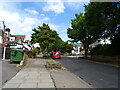
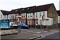
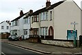

26 photos from this area
Area Information
Key information about the SS0 8AT including its size, population, and administrative classification.
- Area Type
- Postcode
- Area Size
- 7860 m²
- Population
- 1729
- Population Density
- 9971 people/km²
House Prices in SS0 8AT
17
Properties
£379,615
Average Sold Price
£173,500
Lowest Price
£720,000
Highest Price
Showing 17 properties
| Address | Type | Beds | Baths | Last Sale Price | Last Sale Date | |
|---|---|---|---|---|---|---|
| 2 Alleyn Place, Westcliff On Sea, SS0 8AT | Detached | 4 | 2 | £720,000 | Oct 2022 | |
| 23 Alleyn Place, Westcliff On Sea, SS0 8AT | Detached | 4 | 3 | £620,000 | Apr 2021 | |
| 21 Alleyn Place, Westcliff On Sea, SS0 8AT | Detached | 4 | 2 | £580,000 | Dec 2020 | |
| 3 Alleyn Place, Westcliff On Sea, SS0 8AT | Detached | 4 | 3 | £560,000 | Jun 2018 | |
| 11 Alleyn Place, Westcliff On Sea, SS0 8AT | Detached | 3 | 2 | £335,000 | May 2015 | |
| 15 Alleyn Place, Westcliff On Sea, SS0 8AT | Detached | 4 | 2 | £343,500 | Dec 2011 | |
| 10 Alleyn Place, Westcliff On Sea, SS0 8AT | house | 3 | - | £300,000 | Oct 2011 | |
| 19 Alleyn Place, Westcliff On Sea, SS0 8AT | Detached | - | - | £340,000 | Sep 2009 | |
| 1 Alleyn Place, Westcliff On Sea, SS0 8AT | Detached | - | - | £315,000 | Mar 2005 | |
| 4 Alleyn Place, Westcliff On Sea, SS0 8AT | Detached | - | - | £270,000 | Dec 2003 |
Page 1 of 2
Energy Efficiency in SS0 8AT
Amenities
Schools
| Rank | School | Type | Entry gender | Ages |
|---|
Explore more schools in this area
Go to Schools tabDemographics
Household Size
One person
most common
Accommodation Type
Flats
most common
Tenure
44
majority
Ethnic Group
White
most common
Religion
N/A
most common
Household Composition
N/A
most common
Age
47
median
Adults (30-64 years)
most common
Household Deprivation
N/A
with no deprivation
NS-SEC
36
in Lower managerial occupations
Explore more demographic insights in this area
Go to Demographics tabPlanning
Planning Constraints
- Flood RiskPremium
- Ramsar Wetland SitesPremium
- Area of Outstanding Natural BeautyPremium
- Protected Nature ReservePremium
- Protected WoodlandPremium