Area Overview for SS0 7EL
Photos of SS0 7EL
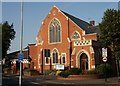
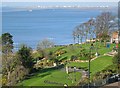
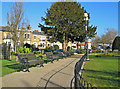
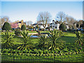

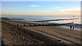
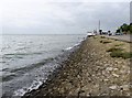
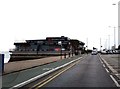
100 photos from this area
Area Information
Key information about the SS0 7EL including its size, population, and administrative classification.
- Area Type
- Postcode
- Area Size
- 7386 m²
- Population
- 2087
- Population Density
- 10246 people/km²
House Prices in SS0 7EL
48
Properties
£287,750
Average Sold Price
£185,500
Lowest Price
£390,000
Highest Price
Showing 48 properties
| Address | Type | Beds | Baths | Last Sale Price | Last Sale Date | |
|---|---|---|---|---|---|---|
| 193A Hamlet Court Road, Westcliff On Sea, SS0 7EL | Maisonette | - | - | £390,000 | Dec 2021 | |
| 197A Hamlet Court Road, Westcliff On Sea, SS0 7EL | Maisonette | - | - | £185,500 | Oct 2012 | |
| 159A Hamlet Court Road, Westcliff On Sea, SS0 7EL | Flat | 1 | 1 | - | - | |
| 175A Hamlet Court Road, Westcliff On Sea, SS0 7EL | Flat | 4 | 1 | - | - | |
| 195A Hamlet Court Road, Westcliff On Sea, SS0 7EL | Retail | 1 | 1 | - | - | |
| 173B Hamlet Court Road, Westcliff On Sea, SS0 7EL | Block of Flats | 2 | - | - | - | |
| 161B Hamlet Court Road, Westcliff On Sea, SS0 7EL | Block of Flats | 1 | - | - | - | |
| Room 2, 183A Hamlet Court Road, Westcliff-on-Sea, SS0 7EL | Unknown | - | - | - | - | |
| Room 3, 183A Hamlet Court Road, Westcliff-on-Sea, SS0 7EL | Unknown | - | - | - | - | |
| 201B Hamlet Court Road, Westcliff On Sea, SS0 7EL | Flat | - | - | - | - |
Page 1 of 5
Energy Efficiency in SS0 7EL
Amenities
Schools
| Rank | School | Type | Entry gender | Ages |
|---|
Explore more schools in this area
Go to Schools tabDemographics
Household Size
One person
most common
Accommodation Type
Flats
most common
Tenure
38
majority
Ethnic Group
White
most common
Religion
N/A
most common
Household Composition
N/A
most common
Age
47
median
Adults (30-64 years)
most common
Household Deprivation
N/A
with no deprivation
NS-SEC
27
in Lower managerial occupations
Explore more demographic insights in this area
Go to Demographics tabPlanning
Planning Constraints
- Flood RiskPremium
- Ramsar Wetland SitesPremium
- Area of Outstanding Natural BeautyPremium
- Protected Nature ReservePremium
- Protected WoodlandPremium