Area Overview for SS0 0JD
Photos of SS0 0JD
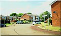
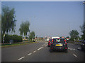
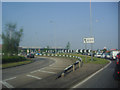
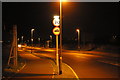
20 photos from this area
Area Information
Key information about the SS0 0JD including its size, population, and administrative classification.
- Area Type
- Postcode
- Area Size
- 1.5 hectares
- Population
- 1444
- Population Density
- 2893 people/km²
House Prices in SS0 0JD
38
Properties
£205,467
Average Sold Price
£56,995
Lowest Price
£425,000
Highest Price
Showing 38 properties
| Address | Type | Beds | Baths | Last Sale Price | Last Sale Date | |
|---|---|---|---|---|---|---|
| 45 Brendon Way, Westcliff On Sea, SS0 0JD | house | - | - | £380,000 | Nov 2023 | |
| 41 Brendon Way, Westcliff On Sea, SS0 0JD | house | 4 | 1 | £425,000 | Jan 2023 | |
| 59 Brendon Way, Westcliff On Sea, SS0 0JD | house | - | - | £325,000 | Aug 2022 | |
| 43 Brendon Way, Westcliff On Sea, SS0 0JD | house | - | - | £300,000 | Nov 2020 | |
| 47 Brendon Way, Westcliff On Sea, SS0 0JD | house | - | - | £375,000 | Sep 2018 | |
| 65 Brendon Way, Westcliff On Sea, SS0 0JD | house | - | - | £252,000 | Jul 2018 | |
| 11 Brendon Way, Westcliff On Sea, SS0 0JD | house | - | - | £148,000 | Aug 2016 | |
| 61 Brendon Way, Westcliff On Sea, SS0 0JD | Semi-detached | 3 | - | £238,000 | Mar 2016 | |
| 67 Brendon Way, Westcliff On Sea, SS0 0JD | Bungalow | 3 | - | £249,500 | Feb 2014 | |
| 3 Brendon Way, Westcliff On Sea, SS0 0JD | house | - | - | £185,000 | Nov 2013 |
Page 1 of 4
Energy Efficiency in SS0 0JD
Amenities
Schools
| Rank | School | Type | Entry gender | Ages |
|---|
Explore more schools in this area
Go to Schools tabDemographics
Household Size
Two person
most common
Accommodation Type
Houses
most common
Tenure
83
majority
Ethnic Group
White
most common
Religion
N/A
most common
Household Composition
N/A
most common
Age
47
median
Adults (30-64 years)
most common
Household Deprivation
N/A
with no deprivation
NS-SEC
32
in Lower managerial occupations
Explore more demographic insights in this area
Go to Demographics tabPlanning
Planning Constraints
- Flood RiskPremium
- Ramsar Wetland SitesPremium
- Area of Outstanding Natural BeautyPremium
- Protected Nature ReservePremium
- Protected WoodlandPremium