Area Overview for SS0 0EX
Photos of SS0 0EX

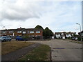
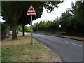
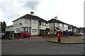
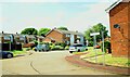


20 photos from this area
Area Information
Key information about the SS0 0EX including its size, population, and administrative classification.
- Area Type
- Postcode
- Area Size
- 1.3 hectares
- Population
- 1583
- Population Density
- 4237 people/km²
House Prices in SS0 0EX
26
Properties
£198,650
Average Sold Price
£37,500
Lowest Price
£310,000
Highest Price
Showing 26 properties
| Address | Type | Beds | Baths | Last Sale Price | Last Sale Date | |
|---|---|---|---|---|---|---|
| 596 Prince Avenue, Westcliff On Sea, SS0 0EX | Terraced | 2 | 1 | £310,000 | Dec 2024 | |
| 614 Prince Avenue, Westcliff On Sea, SS0 0EX | Terraced | 3 | 1 | £305,000 | Aug 2023 | |
| 602 Prince Avenue, Westcliff On Sea, SS0 0EX | Semi-detached | 2 | 1 | £310,000 | May 2022 | |
| 632 Prince Avenue, Westcliff On Sea, SS0 0EX | Terraced | 3 | 1 | £269,995 | Apr 2018 | |
| 630 Prince Avenue, Westcliff On Sea, SS0 0EX | Terraced | 2 | - | £252,000 | Nov 2017 | |
| 634 Prince Avenue, Westcliff On Sea, SS0 0EX | Terraced | 2 | - | £172,000 | Feb 2014 | |
| 640 Prince Avenue, Westcliff On Sea, SS0 0EX | house | - | - | £130,000 | Oct 2012 | |
| 620 Prince Avenue, Westcliff On Sea, SS0 0EX | Semi-detached | - | - | £155,000 | Dec 2006 | |
| 612 Prince Avenue, Westcliff On Sea, SS0 0EX | Terraced | - | - | £45,000 | Nov 1996 | |
| 616 Prince Avenue, Westcliff On Sea, SS0 0EX | Terraced | - | - | £37,500 | Mar 1996 |
Page 1 of 3
Energy Efficiency in SS0 0EX
Amenities
Schools
| Rank | School | Type | Entry gender | Ages |
|---|
Explore more schools in this area
Go to Schools tabDemographics
Household Size
Family (3-5 people)
most common
Accommodation Type
Houses
most common
Tenure
52
majority
Ethnic Group
White
most common
Religion
N/A
most common
Household Composition
N/A
most common
Age
47
median
Adults (30-64 years)
most common
Household Deprivation
N/A
with no deprivation
NS-SEC
24
in Lower managerial occupations
Explore more demographic insights in this area
Go to Demographics tabPlanning
Planning Constraints
- Flood RiskPremium
- Ramsar Wetland SitesPremium
- Area of Outstanding Natural BeautyPremium
- Protected Nature ReservePremium
- Protected WoodlandPremium