Area Overview for Sproughton & Pinewood Ward
Photos of Sproughton & Pinewood Ward
Area Information
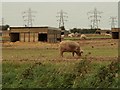
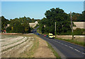
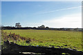
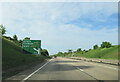
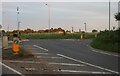
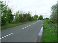
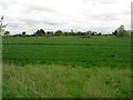
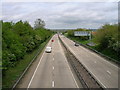
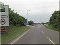
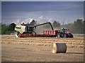
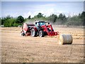
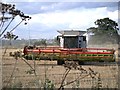
Sproughton & Pinewood Ward sits within Babergh District Council in Suffolk, covering an area size of 9.9 km². This district electoral ward combines two parishes with sharply contrasting identities. Sproughton is characterised as rural in identity, offering a quiet, countryside lifestyle. Conversely, Pinewood is more urban in character and maintains close links with Ipswich. Residents in Sproughton & Pinewood Ward must navigate these distinct environments within a single administrative boundary. Local residents and the Parish Council have previously argued that the pairing of these two parishes within one ward creates an artificial grouping, given their different natures. This tension highlights that life here is not a uniform experience. You will find yourself toggling between the tranquillity of the rural north and the accessibility of the urban south. The ward is located in the Eastern English Region, positioning it near Ipswich for those requiring larger city amenities. Pinewood Surgery serves the local medical needs of the area, situated on Laburnum Close. When considering living in Sproughton & Pinewood Ward, you must accept that your daily life will vary significantly depending on which side of the ward you call home. The area offers neither the homogeneous rural feel nor the dense urban sprawl of a single settlement. Instead, it presents a split identity that defines the unique character of this specific section of Suffolk.
- Area Type
- District Borough Unitary Ward
- Area Size
- 9.9 km²
- Population
- Not available
- Population Density
- Not available
Demographics
The community profile of Sproughton & Pinewood Ward reveals a distinctly older population. The median age in the ward reaches 70 years. This figure suggests that the area is heavily populated by retirees or older couples seeking a peaceful environment. The most common age range recorded is simply listed as "Age: Total", indicating a broad spread skewed heavily towards the senior demographic. You are unlikely to find young families dominating the streets, although schools near Sproughton & Pinewood Ward may serve nearby areas. Home ownership is entrenched as a major feature of daily life with 70% of households owning their property. This high rate of ownership contrasts sharply with the rental markets found in many parts of the UK. The predominance of owner-occupiers aligns with the rural and semi-rural nature of the parishes. Data on the specific ethnic group and predominant religion for the ward is not detailed in the available records, suggesting a relatively homogenous community typical of older, established villages. The household composition data is recorded generally as "total", but the high ownership percentage implies stable, long-term residents rather than transient tenants. When looking at homes in Sproughton & Pinewood Ward, the 70% ownership statistic is the defining demographic characteristic. It points to an area where people stay and build their lives rather than moving on frequently.
Household Size
Accommodation Type
Tenure
Ethnic Group
Religion
Household Composition
Age
Household Deprivation
NS-SEC
Explore more demographic insights in this area
Go to Demographics tabPlanning
Planning Constraints
- Flood RiskLocked
- Ramsar Wetland SitesLocked
- Area of Outstanding Natural BeautyLocked
- Protected Nature ReserveLocked
- Protected WoodlandLocked
- Crime RiskLocked