Area Overview for Sproughton
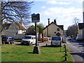
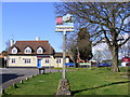
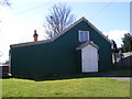
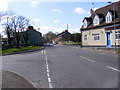
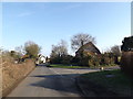
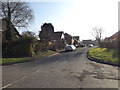
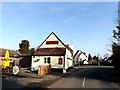
Photos of Sproughton


Area Information
Sproughton is a compact built-up area in England, spanning 34.2 hectares. It is a place where daily life revolves around a tight-knit community, with residents often familiar with their neighbours. The area’s demographic profile suggests a population skewed towards older age groups, with a median age of 70. This hints at a stable, long-term resident base, though the data does not specify the exact population size. Sproughton’s appeal lies in its proximity to essential services, including two primary schools and multiple retail and transport options. The presence of Asda, Aldi, and Morrisons within walking distance, alongside nearby railway stations, ensures practical connectivity for residents. While the broadband quality score is modest at 42, mobile coverage is stronger at 78, supporting basic digital needs. For those seeking a quiet, established neighbourhood with accessible amenities, Sproughton offers a blend of simplicity and convenience, though its character is defined more by its community structure than by modern developments.
- Area Type
- Built Up Area 250
- Area Size
- 34.2 hectares
- Population
- Not available
- Population Density
- Not available
The lifestyle in Sproughton is shaped by its proximity to retail and transport hubs. Within practical reach are major supermarkets such as Asda Sproughton, Aldi Europa, and Morrisons Westbourne, offering a range of shopping options for daily needs. The five nearby railway stations provide easy access to commuting routes, enhancing the area’s connectivity to surrounding towns. While the data does not mention parks or leisure facilities, the presence of multiple retail outlets and transport links suggests a practical, service-oriented lifestyle. Residents can access essentials without long journeys, though the absence of detailed information on recreational spaces means the area’s leisure options remain unquantified. For those prioritising convenience over expansive amenities, Sproughton offers a functional environment with a focus on accessibility and local services.
Amenities
Schools
Sproughton is served by two primary schools: Sproughton Church of England Voluntary Controlled Primary School and Sproughton Church of England Primary School. Both institutions cater to the needs of local families, though the data does not include Ofsted ratings or academic performance metrics. The presence of two primary schools within the area suggests a focus on early education, potentially reducing the need for long commutes to secondary schools. For parents, this provides a choice of local options, though the absence of secondary schools or further education facilities means families may need to consider nearby towns for higher education. The schools’ church-affiliated status may also influence their ethos and community engagement, though this is not quantified in the data.
| Rank | A + A* % | School | Type | Entry gender | Ages |
|---|---|---|---|---|---|
| 1 | N/A | Sproughton Church of England Voluntary Controlled Primary School | primary | N/A | N/A |
| 2 | N/A | Sproughton Church of England Primary School | primary | N/A | N/A |
Explore more schools in this area
Go to Schools tabDemographics
Sproughton’s demographic profile is defined by its median age of 70, indicating a population predominantly composed of older adults. This suggests a community with a strong emphasis on stability and long-term residency. Home ownership is high at 80%, reflecting a preference for property as a long-term investment rather than rental housing. The data does not specify household composition or accommodation types, but the overall figures imply a mix of family and single-person households. The absence of detailed information on ethnic diversity or religious composition means the area’s cultural makeup remains unquantified. For residents, this demographic structure may influence local services and amenities, with a focus on healthcare and community support. While the data does not provide direct indicators of deprivation, the high home ownership rate and stable age profile suggest a relatively low dependency on social welfare, which could contribute to a sense of self-sufficiency among residents.
Household Size
Accommodation Type
Tenure
Ethnic Group
Religion
Household Composition
Age
Household Deprivation
NS-SEC
Explore more demographic insights in this area
Go to Demographics tabPlanning
Planning Constraints
- Crime RiskLocked