Area Overview for Sporle with Palgrave
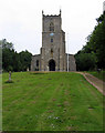
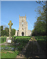
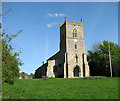
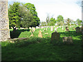
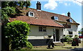
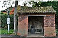
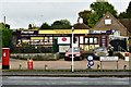
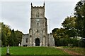
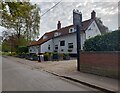
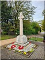
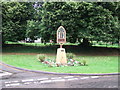
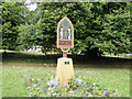
Photos of Sporle with Palgrave
Area Information
Living in Sporle with Palgrave offers a distinct experience within a civil parish that spans 17.2 km² of land in England. You will find a setting defined by its rural character, where the average resident enjoys substantially more space between borders than in dense urban centres. This specific parish status means local governance and community focus remain tightly aligned with the immediate surroundings, fostering a lifestyle that is deeply connected to the land. You move through an area where the architecture and layout have likely evolved alongside the natural landscape, creating a neighbourhood that feels separate from the busier towns nearby. The scale of the parish supports a quiet pace of life, away from the congestion and noise of larger production centres. Your daily routine here involves navigating a compact yet meaningful territory where local shops, walking paths, and community spaces are easily accessible within the established ground. This environment attracts those who prioritise tranquillity and prefer a neighbourhood where the boundaries of their home extend further into the countryside.
- Area Type
- Parish
- Area Size
- 17.2 km²
- Population
- Not available
- Population Density
- Not available
Demographics
The community in Sporle with Palgrave presents a clear profile of an established, settled population. You will encounter a resident base with a median age of 70, indicating that this is an area predominantly inhabited by older adults. This demographic reality shapes the daily rhythm of the neighbourhood, with a focus on retirement living and long-term residency. Analysis of household composition confirms that families with young children are less common, while the home ownership rate stands at a remarkable 71%. You are significantly more likely to purchase a property in Sporle with Palgrave than to find a rental arrangement, as the vast majority of residents have built equity in their homes over many years. Although specific details regarding predominant ethnic groups or religious affiliations are not quantified in the available records, the overall picture suggests a stable, mono-generational community. This lack of transient movement supports continuity and a shared understanding of local history among those calling Sporle with Palgrave home.
Household Size
Accommodation Type
Tenure
Ethnic Group
Religion
Household Composition
Age
Household Deprivation
NS-SEC
Explore more demographic insights in this area
Go to Demographics tabPlanning
Planning Constraints
- Flood RiskPremium
- Ramsar Wetland SitesPremium
- Area of Outstanding Natural BeautyPremium
- Protected Nature ReservePremium
- Protected WoodlandPremium
- Crime RiskPremium