Area Overview for Southrepps
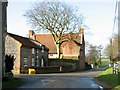
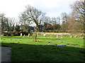
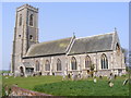
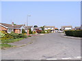
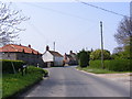
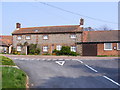
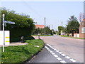
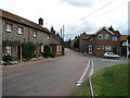
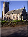
Photos of Southrepps


Area Information
Southrepps is a compact built-up area spanning 27.5 hectares, nestled in England. Its small size means it is a tightly knit community, with residents often knowing their neighbours. The area’s demographic profile is notable: the median age is 70, suggesting a population skewed towards older adults. This is reflected in the high home ownership rate of 76%, indicating long-term residency and stability. Daily life here is shaped by proximity to key amenities. Five rail stations—Gunton, Roughton Road, and Cromer among them—offer easy access to nearby towns and cities, while local shops like Spar, Tesco Mundesley, and Waitrose North provide practical retail options. The area’s low crime risk, with a safety score of 86, adds to its appeal for those prioritising security. For buyers, Southrepps offers a blend of convenience and tranquillity, with a focus on accessibility and community cohesion. Its modest size ensures a sense of familiarity, though it may lack the diversity of larger urban centres.
- Area Type
- Built Up Area 250
- Area Size
- 27.5 hectares
- Population
- Not available
- Population Density
- Not available
Living in Southrepps offers access to essential retail and transport hubs within practical reach. Local shops such as Spar, Tesco Mundesley, and Waitrose North provide everyday convenience, from groceries to household supplies. The presence of five rail stations, including Gunton and Cromer, ensures easy access to broader regional networks, supporting both daily commutes and weekend travel. While the data does not mention parks or leisure facilities, the proximity to rail and retail suggests a lifestyle focused on accessibility rather than expansive green spaces. The area’s character is defined by its compactness and the reliability of its infrastructure, making it suitable for those who prioritise convenience over sprawling amenities. The limited size of the area means residents are likely to rely on nearby towns for more extensive leisure options, though the existing facilities meet basic needs effectively.
Amenities
Schools
| Rank | School | Type | Entry gender | Ages |
|---|
Explore more schools in this area
Go to Schools tabDemographics
Southrepps has a median age of 70, with the most common age range encompassing all demographics. This suggests a population that is predominantly older, which aligns with the 76% home ownership rate—indicating a community where residents are likely to have lived for many years. The data does not specify household composition or accommodation types, but the overall figures imply a stable, settled population. There are no details on ethnic diversity or religious composition, but the absence of specific breakdowns means the area’s cultural makeup remains less defined. The high home ownership rate also suggests limited rental properties, which could affect the availability of short-term housing. For those considering relocation, the age profile and ownership patterns indicate a quiet, low-turnover environment, though it may not cater to families or younger professionals seeking dynamic growth.
Household Size
Accommodation Type
Tenure
Ethnic Group
Religion
Household Composition
Age
Household Deprivation
NS-SEC
Explore more demographic insights in this area
Go to Demographics tabPlanning
Planning Constraints
- Crime RiskPremium