Area Overview for South Oxhey Ward
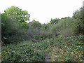
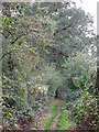
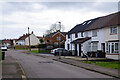
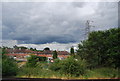
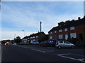
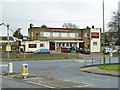
Photos of South Oxhey Ward


Area Information
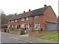
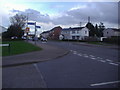
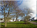
South Oxhey Ward is a compact residential district covering an area of just 2.0 km² within the London Borough of Hillingdon. Despite its small footprint, it houses 1,706 residents, resulting in a population density of 864 people per square kilometre. This high density suggests a neighbourhood where homes are situated closely together, creating an intimate community scale rather than a sprawling suburban sprawl. Living in South Oxhey Ward means navigating a tightly knit environment where local services and amenities are inevitably in close proximity to one another. The ward functions as a distinct community unit, separate from the wider borough, yet integrated into the broader transport and commercial networks of west London. Prospective buyers should note that this is a mature ward where daily life revolves around immediate neighbourhood interactions and local infrastructure. The compact size means that walking distances play a significant role in daily routines, whether accessing schools, shops, or transport links. While the area offers a defined sense of place, the lack of large green spaces within the ward boundary means residents often look to surrounding areas for wider recreational facilities. The ward represents a specific slice of suburban London life, characterised by its small size and relatively high concentration of households. Understanding the physical scale of South Oxhey Ward is essential for visualising the daily rhythm of life here, where boundaries are clear and the community footprint is concentrated.
- Area Type
- District Borough Unitary Ward
- Area Size
- 2.0 km²
- Population
- 1706
- Population Density
- 864 people/km²
Demographics
The community profile of South Oxhey Ward reveals a mature population with a median age of 70 years. This figure indicates that more than half of the residents are over the age of seventy, distinguishing the ward from many younger, growing neighbourhoods in London. Such an age profile often points towards a community established frequently by retirees or older families who have stayed in the area for decades. With a home ownership rate of 49%, residents are equally split between owning their property outright or with a mortgage and those who rent. This balance contrasts with other London suburbs that may show higher levels of tenancy. Although specific data on household composition, predominant ethnic groups, religious affiliations, and accommodation types are not individually broken down in the available statistics, the overall demographics provide a clear picture of community stability. The lack of a young median age suggests that schools and youth-focused facilities might have different pressures compared to areas with families under thirty. The 49% ownership rate implies a stable, long-term resident base rather than a transient rental market. Living in South Oxhey Ward means interacting with a population where life experience outweighs youthful mobility, creating a quiet, established residential environment. This demographic reality shapes the local services and social dynamics, prioritising healthcare, leisure, and quiet living over the amenities catering to young professionals.
Household Size
Accommodation Type
Tenure
Ethnic Group
Religion
Household Composition
Age
Household Deprivation
NS-SEC
Explore more demographic insights in this area
Go to Demographics tabPlanning
Planning Constraints
- Flood RiskPremium
- Ramsar Wetland SitesPremium
- Area of Outstanding Natural BeautyPremium
- Protected Nature ReservePremium
- Protected WoodlandPremium