Area Overview for South Hanningfield, Stock and Margaretting Ward
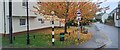
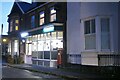
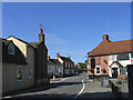
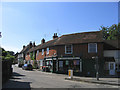
Photos of South Hanningfield, Stock and Margaretting Ward
Area Information
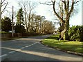
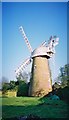
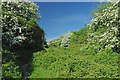
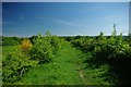
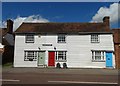
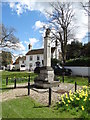
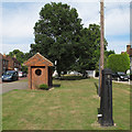
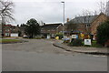
South Hanningfield, Stock and Margaretting Ward is a vast electoral ward within the Chelmsford district unitary authority in Eastern England. This district covers 46.2 square kilometres, making it the second largest ward in Chelmsford by area. The landscape features attractive open countryside interspersed with established settlements, giving the area a predominantly rural character. Main settlements include Stock, Margaretting, South Hanningfield, Ramsden Heath, and Downham. The total population stands at 5,576 according to the 2021 census. You will find this spread across 2,296 households with an average household size of 2.4 people. One of the most defining features is the Hanningfield Reservoir and Nature Reserve, which sits within the boundary. The A12 trunk road and a mainline railway pass through the northern half of the ward. South Hanningfield village lies approximately six miles south-southeast of Chelmsford city centre. You will also encounter Margaretting Level Crossing during your travels across the northern sections. For those considering homes in this ward, the low population density stands at only 1.2 people per hectare. This spacious feel contrasts with typical urban environments. The ward encompasses five distinct parishes that offer varied local experiences.
- Area Type
- District Borough Unitary Ward
- Area Size
- 46.2 km²
- Population
- Not available
- Population Density
- Not available
Demographics
The community in South Hanningfield, Stock and Margaretting Ward displays a clear demographic skew towards older residents. The median age reaches 70, peaking in the older age brackets. This profile suggests the area is a retirement destination or a place favoured by families with empty nesters. Census data shows that 81 percent of residents own their homes outright or with a mortgage. This high rate of home ownership indicates deep community roots and stability within the parish boundaries. You will find limited rental activity compared to student-led cities or commuter villages for young professionals. The household composition reflects an average size of 2.4 people per household, a figure consistent with an area containing households with children or couples nearing retirement. No specific predominate ethnicity or religious breakdown is available in the current dataset. Instead, the population structure suggests a stable, settled community rather than a transient population. This demographic reality matters when you evaluate schools near the area or local services. A population centred around the 70-year-old median age will have different needs than a youthful neighbourhood. The low housing density of 1.2 people per hectare further reinforces the quiet, established nature of this ward.
Household Size
Accommodation Type
Tenure
Ethnic Group
Religion
Household Composition
Age
Household Deprivation
NS-SEC
Explore more demographic insights in this area
Go to Demographics tabPlanning
Planning Constraints
- Flood RiskPremium
- Ramsar Wetland SitesPremium
- Area of Outstanding Natural BeautyPremium
- Protected Nature ReservePremium
- Protected WoodlandPremium
- Crime RiskPremium