Area Overview for South Hanningfield
Photos of South Hanningfield


Area Information
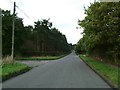
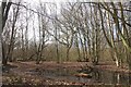
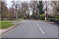
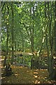
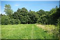
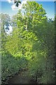
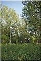
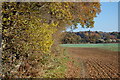
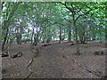
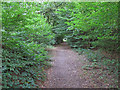
South Hanningfield sits as a distinct civil parish within the Chelmsford district of Essex, covering an area size of 17.1 km². The location rests on the south bank of the Hanningfield Reservoir, placing it approximately six miles from Chelmsford city centre and around two and a half miles north of Wickford. Daily life revolves around the village centre, which is positioned at the junction of South Hanningfield Road and Middlemead. This hub connects the area to Downham, Rettendon Common, and West Hanningfield, forming the primary artery for local movement. The landscape is dominated by the reservoir, the second largest in Essex, which serves as a major recreational draw. Visitors access extensive picnic areas, a public car park, and a waterside café known as Café on the Water. Bird-watching facilities operate within the site, which is protected by a Bird Sanctuary Order. St Peter's Church remains a notable historical landmark anchored in the community. The village green, or Tye, anchors the social spirit of the locality. Living in South Hanningfield means residing in a settlement where the reservoir defines the view and recreation opportunities. The area offers a specific rural character defined by its water frontage and proximity to larger town centres without being immediately adjacent to them.
- Area Type
- Parish
- Area Size
- 17.1 km²
- Population
- Not available
- Population Density
- Not available
Demographics
The community in South Hanningfield reflects an established settlement with a median age recorded at 70 years. This demographic profile indicates a population heavily weighted towards older residents compared to national averages. The most common age range category lists 'Age: Total', reflecting the aggregated data structure available for analysis. Home ownership stands at a high level of 88%, signalling that the vast majority of residents own their properties outright or have a substantial mortgage. This figure suggests a deep-rooted community where families and individuals have long-term ties to the locality. Household composition and accommodation type data are recorded as 'total', indicating the aggregates represent the sum of all dwelling types rather than specific breakdowns. There is no record of predominant ethnicity or specific religious affiliation in the provided data set. The demographic reality points towards a quiet, stable environment where long-term residents form the core of the population. Safety scores further reinforce this stable environment, with a crime risk assessment showing a score of 79 out of 100. This low risk indicator confirms that the neighbourhood operates under safe conditions suitable for this established demographic. The population dynamics suggest a low turnover area where community bonds likely run deep.
Household Size
Accommodation Type
Tenure
Ethnic Group
Religion
Household Composition
Age
Household Deprivation
NS-SEC
Explore more demographic insights in this area
Go to Demographics tabPlanning
Planning Constraints
- Flood RiskPremium
- Ramsar Wetland SitesPremium
- Area of Outstanding Natural BeautyPremium
- Protected Nature ReservePremium
- Protected WoodlandPremium
- Crime RiskPremium