Area Overview for South East Cosford Ward
Photos of South East Cosford Ward
Area Information
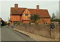
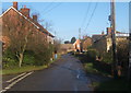
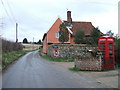
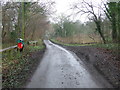
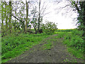
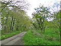
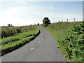
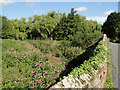
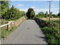
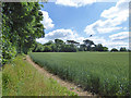
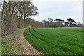
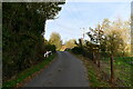
Living in South East Cosford Ward offers a distinctly rural experience within the Babergh District of Suffolk. This ward covers an area of 51.9 square kilometres and forms part of the South Suffolk County Constituency. You will find yourself situated in the north of Babergh, surrounded by parishes near Lavenham and Polstead. The location sits around the coordinates 52.0775°N, 0.9403°E, placing you deep within the countryside of the Eastern Region of England. Daily life here revolves around the quiet rhythms of the village, away from the pace of larger urban centres. The landscape is defined by open spaces and traditional rural settings rather than dense development or high-rise blocks. This area functions as a settled community where residents enjoy proximity to historical towns without living in their shadow. Nearby settlements like Lavenham provide access to local shops while maintaining that escape from city noise. The ward does not contain areas of outstanding natural beauty protection or Ramsar wetland sites, which means development planning follows standard rural guidelines rather than strict conservation rules for waterbirds. However, you must be aware that protected woodland exists within the boundaries, which can influence future local planning decisions. For those considering moving to this location, the rural nature is the defining characteristic. You are not buying into a bustling town centre but rather into a peaceful stretch of countryside. The character of the place attracts those seeking stability and a connection to the land. Families home-schooling or retirees looking for space will find the environment suits their requirements well. The surroundings offer a traditional English village lifestyle with open fields and established community patterns.
- Area Type
- District Borough Unitary Ward
- Area Size
- 51.9 km²
- Population
- Not available
- Population Density
- Not available
Demographics
The community profile of South East Cosford Ward differs significantly from many other parts of the country. The median age is 70 years old, indicating an older population demographic. This figure suggests that the area has a higher than average proportion of residents over the age of 50. Conversely, there is a lower proportion of working-age people compared to national averages. This age structure shapes the local economy and social infrastructure in specific ways. Home ownership stands at 80 per cent across the ward. This high figure means the majority of residents own their homes outright or have a mortgage. Most people in South East Cosford Ward live in families or as older couples rather than renting. The accommodation types reflect this long-term settlement pattern. You will find a housing stock designed for people staying in one place for many years rather than temporary tenancy arrangements. The household composition shows a dominance of total household types typical for rural retirement or established family living. The area hosts a predominantly English population, though specific figures for other ethnic groups are not detailed in this dataset. Religion and specific ethnic breakdowns remain part of the total count without further subdivision in the available records. This demographic stability contributes to a settled atmosphere where neighbours know each other over generations. The lack of a large working-age population means local businesses may focus on services for residents rather than commuter hubs.
Household Size
Accommodation Type
Tenure
Ethnic Group
Religion
Household Composition
Age
Household Deprivation
NS-SEC
Explore more demographic insights in this area
Go to Demographics tabPlanning
Planning Constraints
- Flood RiskPremium
- Ramsar Wetland SitesPremium
- Area of Outstanding Natural BeautyPremium
- Protected Nature ReservePremium
- Protected WoodlandPremium
- Crime RiskPremium