Area Overview for South Creake
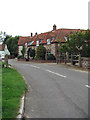
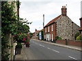
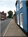
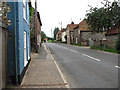
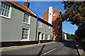
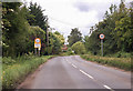
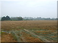
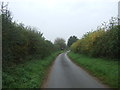
Photos of South Creake
Area Information
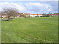
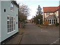
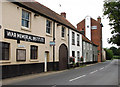
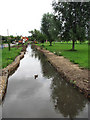
South Creake is a civil parish covering an area of 20.2 square kilometres. It stands as a defined rural settlement in England where the pace of life remains slow and measured. You will find a location that prioritises quiet over urban amenities, offering a distinct escape from the busiest parts of Norfolk. The parish operates as a self-contained community with clear geographical boundaries and a straightforward layout. Residents here can walk to local fields or explore the wider countryside within a short drive. This environment suits those who value space and privacy without needing to commute to a major city centre for daily necessities. The layout supports a tranquil lifestyle where neighbours know each other well and the streets are generally quiet. Living in South Creake means accepting that basic services may require a journey into nearby towns. You will appreciate the open skies and the lack of roadside congestion that characterises this sparsely populated region. The area functions best for people who have established their careers elsewhere or prefer remote working arrangements. It serves as a peaceful retreat where you can enjoy the natural surroundings of East Anglia. Visitors and new buyers often note that the distinct lack of development pressure helps preserve the character of the village and its immediate hinterland. The overall impression is one of stability and continuity, making it an attractive option for those seeking a traditional English village experience.
- Area Type
- Parish
- Area Size
- 20.2 km²
- Population
- Not available
- Population Density
- Not available
Demographics
The community profile in South Creake reflects a mature population with little recent growth compared to larger urban centres. Statistics indicate that the median age of residents is 70 years old. This figure places the demographic composition firmly within older age brackets, suggesting a retirement or semi-retirement population dominates the local scene. You will encounter a neighbourhood where many households consist of older couples or individuals enjoying their later years. The most common age range recorded as "Total" confirms that the area does not fluctuate significantly between younger and older cohorts. Home ownership is a central feature of life here, with 68 per cent of homes being owned outright or with a mortgage. This high rate of ownership contrasts sharply with rental-dominated cities and points to long-term residents who have invested in the property market over decades. Household composition data is recorded as "total", indicating a stable family structure without significant transient populations. Ethnic diversity and religious affiliations are noted as "total", which suggests a relatively homogenous community where cultural traditions have remained consistent over time. This demographic stability means you are buying into an established social network rather than a rapidly evolving diversifying area. The low turnover rate helps maintain familiarity among residents, creating a supportive environment for newcomers who share similar life stages and needs.
Household Size
Accommodation Type
Tenure
Ethnic Group
Religion
Household Composition
Age
Household Deprivation
NS-SEC
Explore more demographic insights in this area
Go to Demographics tabPlanning
Planning Constraints
- Flood RiskPremium
- Ramsar Wetland SitesPremium
- Area of Outstanding Natural BeautyPremium
- Protected Nature ReservePremium
- Protected WoodlandPremium
- Crime RiskPremium