Area Overview for Sloley
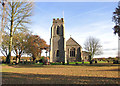
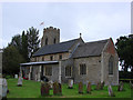
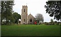
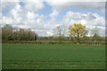
Photos of Sloley
Area Information
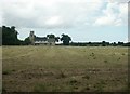
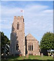
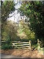
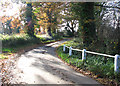
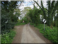
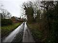
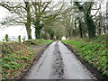
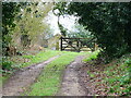
Sloley is a small civil parish in England covering just three square kilometres. It is a low-density community where time moves slowly compared to larger towns. You will find a quiet setting suitable for those seeking peace rather than urban intensity. The limited size of the area means that daily interactions are intimate and neighbours are likely to know each other. Life here centres on routine and stability within a compact geographical boundary. Prospective buyers considering living in Sloley must understand they are choosing a retreat from the hustle of bigger supermarkets and transport hubs. The environment offers open space without the noise of heavy industry. There are no large commercial districts within the parish itself. Residents rely on nearby settlements for major shopping or cinema visits. This layout supports a lifestyle where the car is a necessary tool for most errands. The residential focus of the area ensures that streets remain relatively free from commercial traffic at odd hours. If you value seclusion, this location provides it. However, you should plan your budget for travel time to employment centres. The character of Sloley is defined by its size and the prevalence of private homes.
- Area Type
- Parish
- Area Size
- 3.0 km²
- Population
- Not available
- Population Density
- Not available
Demographics
The community in Sloley has a very distinct age profile. The median age is seventy years old. This figure indicates that the population is older than the national average. You are looking at a neighbourhood populated largely by retirees or people who have lived here for decades. There is no young family demographic in the current statistics. The most common age range data lists "Age: Total", which aligns with the high median figure. Home ownership stands at sixty-three per cent. More than three in five households own their roofs. This high rate suggests long-term stability rather than a transient student or rental market. Non-owners remain in a minority, but the area is not exclusively owned either. Household composition data refers to the "total" category, which simplifies the breakdown of single-person versus multi-generational homes. The demographic stats do not specify ethnic groups, religions, or specific employment breakdowns beyond age. Living in this community means interacting with an older cohort daily. Social activities will likely revolve around health, leisure, or local clubs rather than youth sports. You can expect an environment dominated by established residents who value consistency. The sixty-three per cent ownership rate reduces turnover pressure on the housing market. If you are a younger buyer, you may find fewer vacant properties targeting young families. The demographic reality is a mature settlement with a specific rhythm and a senior-focused social fabric.
Household Size
Accommodation Type
Tenure
Ethnic Group
Religion
Household Composition
Age
Household Deprivation
NS-SEC
Explore more demographic insights in this area
Go to Demographics tabPlanning
Planning Constraints
- Flood RiskPremium
- Ramsar Wetland SitesPremium
- Area of Outstanding Natural BeautyPremium
- Protected Nature ReservePremium
- Protected WoodlandPremium
- Crime RiskPremium