Area Overview for Slip End
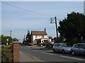
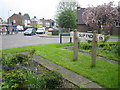
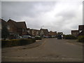
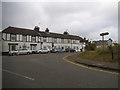
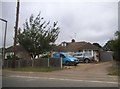
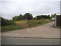
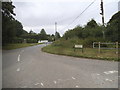
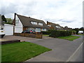
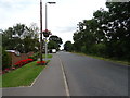
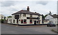
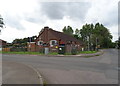
Photos of Slip End

Area Information
Slip End is a small, built-up area in England covering 49 hectares, offering a quiet, compact living environment. With a median age of 70, the community is predominantly older, suggesting a mature demographic profile. The area is notable for its strong home ownership rate of 82%, indicating a stable, long-term resident base. Daily life here is shaped by proximity to essential services, including Slip End Village School, which provides a good Ofsted-rated primary education for local families. The area’s digital connectivity is robust, with broadband rated at 100 (excellent) and mobile coverage at 84 (good), supporting both work and leisure needs. Transport links are practical, with four railway stations within reach, including Luton Airport Parkway, and two nearby airports. While Slip End lacks the density of larger towns, its size and amenities make it a convenient base for those prioritising accessibility to transport, retail, and green spaces. The area’s character is defined by its balance of simplicity and connectivity, appealing to those seeking a low-maintenance lifestyle without sacrificing convenience.
- Area Type
- Built Up Area 250
- Area Size
- 49.0 hectares
- Population
- Not available
- Population Density
- Not available
Slip End’s lifestyle is shaped by its proximity to essential amenities within practical reach. The area has five retail outlets, including Spar and two Co-ops (Caddington and Whipperley), providing everyday shopping convenience. For transport, four railway stations offer access to local and regional routes, while two nearby airports (London Luton) cater to travel needs. Though the data does not mention parks or leisure facilities, the presence of retail and transport hubs suggests a functional, low-maintenance lifestyle. The compact nature of Slip End means residents can access daily necessities without long commutes, though the area’s charm may lie in its simplicity rather than extensive recreational options. The combination of retail, rail, and airport access makes it a practical choice for those seeking a self-contained environment with minimal reliance on distant amenities.
Amenities
Schools
Slip End’s educational provision is anchored by Slip End Village School, a primary school with a good Ofsted rating. This institution serves the local community, offering a foundation for young families seeking quality education within walking distance. The absence of secondary schools in the data means families may need to look beyond Slip End for high school options, though nearby towns could provide alternatives. The presence of a single primary school with a strong rating is a positive factor for families prioritising education, though the lack of comprehensive data on school catchment areas or performance metrics limits a fuller assessment. For those considering Slip End, the school’s good rating is a clear advantage, but additional research into secondary education options would be necessary to ensure a complete educational pathway for children.
| Rank | School | Type | Entry gender | Ages |
|---|
Explore more schools in this area
Go to Schools tabDemographics
The population of Slip End has a median age of 70, reflecting a community skewed towards older adults. This demographic profile suggests a mature, stable population with a focus on established living rather than family growth. Home ownership is high, with 82% of residents owning their homes, indicating a lack of rental demand and a preference for long-term residency. The data does not specify household composition or accommodation types, but the overall home ownership rate implies a settled, less transient population. The area’s demographics are not explicitly detailed in terms of ethnic or religious diversity, but the figures provided suggest a homogenous community. The absence of specific data on deprivation or diversity means the area’s social dynamics remain largely unexplored in the provided information. For prospective buyers, the high home ownership rate and older demographic may indicate a quieter, more traditional environment, though further local insights would be needed to fully understand the community’s character.
Household Size
Accommodation Type
Tenure
Ethnic Group
Religion
Household Composition
Age
Household Deprivation
NS-SEC
Explore more demographic insights in this area
Go to Demographics tabPlanning
Planning Constraints
- Crime RiskPremium