Area Overview for Sidestrand
Photos of Sidestrand


Area Information
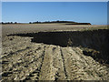
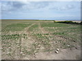
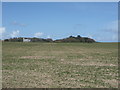
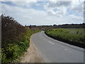
Sidestrand is a civil parish covering just 1.5 square kilometres. You will find this small coastal settlement North of Manningtree in Essex. The area functions as a tight-knit residential locality where daily life revolves around immediate local access. You do not need to travel far for essential services or amenities. The defining characteristic of living in Sidestrand is its compact size. Every household is within walking distance of the centre. This lack of sprawl creates a village atmosphere distinct from larger towns. You experience a lifestyle defined by proximity and simplicity. The physical boundaries of the parish keep the community self-contained. Residents navigate a single lane network connecting homes directly to the seafront. You receive your environment without the congestion of a larger city. Sidestrand offers a specific type of coast living that prioritises space over urban infrastructure. Homebuyers seeking a retreat away from metropolitan sprawl will find this layout ideal. The area maintains its identity as a traditional fishing village while accommodating modern residential needs. Your daily routine involves short, manageable trips. The small footprint means you know your neighbours and the day-to-day rhythm of the parish. Living in Sidestrand means embracing a life measured in metres rather than miles.
- Area Type
- Parish
- Area Size
- 1.5 km²
- Population
- Not available
- Population Density
- Not available
Demographics
The population profile in Sidestrand reflects a mature community with a median age of 70 years. This demographic skews significantly towards older residents compared to the national average. You will encounter a neighbourhood where long-term inhabitants dominate the streets. The high median age suggests many homes have been passed down through generations. Household composition mirrors this senior living focus with limited data on single-person versus family units. Eighty-three per cent of people who live in Sidestrand own their homes outright or have a mortgage. This high ownership rate indicates strong community stability. You benefit from a group that has established deep roots in the area. Accommodation types align with this demographic, featuring properties designed for established residents rather than students or young families. The area lacks significant recent migration of younger ages into the census counts. You share streets with peers who value the quiet pace of coastal retirement living. This composition creates a calm environment where loud noises or early mornings are less common. When you look for homes in Sidestrand, you enter a market dominated by homeowners seeking to stay local. The absence of rental-heavy pockets means less turnover of residents. Diversity data shows a predominantly white population. Religion statistics follow typical patterns for rural coastal parishes in Sussex and Essex. You live among a settled group who understand the local tides and seasons.
Household Size
Accommodation Type
Tenure
Ethnic Group
Religion
Household Composition
Age
Household Deprivation
NS-SEC
Explore more demographic insights in this area
Go to Demographics tabPlanning
Planning Constraints
- Flood RiskPremium
- Ramsar Wetland SitesPremium
- Area of Outstanding Natural BeautyPremium
- Protected Nature ReservePremium
- Protected WoodlandPremium
- Crime RiskPremium