Area Overview for Shipmeadow
Photos of Shipmeadow

Area Information
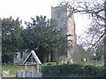
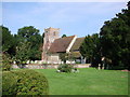
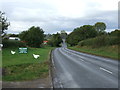
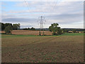
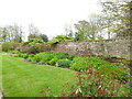
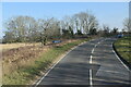
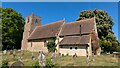
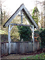
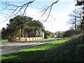
Shipmeadow is a small civil parish and rural village situated within East Suffolk, situated approximately 2.5 miles west-south-west of Beccles. This community spans just 3.3 km², a compact footprint that defines a quiet, village-centric lifestyle. The settlement straddles the busy road connecting Beccles and Bungay, placing it at the edge of the Waveney Valley rather than deep within the countryside. Historical records show the parish peaked at a population of 515 in 1851, though today it has much reduced numbers following the decline of the union workhouse era in the 19th century. You will find the former Church of St Bartholomew as a notable landmark. This 13th-century building features a late medieval tower restored in the late 19th century by the Suckling family. The church now serves as residential housing, yet it retains its historic churchyard and the World War One lychgate memorial. Living in Shipmeadow means residing in a location defined by its history and proximity to larger towns like Beccles and Bungay, offering a blend of rural character and practical access to local services.
- Area Type
- Parish
- Area Size
- 3.3 km²
- Population
- Not available
- Population Density
- Not available
Demographics
The community profile of Shipmeadow reflects a mature population deeply rooted in the parish. The median age for residents is 70, indicating this is an area predominantly inhabited by older adults. The demographic data identifies "Age: Total" as the most common age range category recorded within the parish boundaries. Home ownership stands at a high rate of 76%, suggesting that a vast majority of households in Shipmeadow own their residences outright or via mortgage rather than renting. This strong ownership level typically accompanies a stable, long-term resident base with deep local ties. There is no specific data available regarding household composition breakdowns, predominant ethnic groups, or religious affiliations in the current records, so these specific cultural details remain undefined in the available information. You should understand that the social fabric here is shaped primarily by older homeowners rather than young families or transitory tenants. The absence of conflicting data on ethnicity and religion points to a traditional, locally established community where heritage may play a significant role in daily life.
Household Size
Accommodation Type
Tenure
Ethnic Group
Religion
Household Composition
Age
Household Deprivation
NS-SEC
Explore more demographic insights in this area
Go to Demographics tabPlanning
Planning Constraints
- Flood RiskPremium
- Ramsar Wetland SitesPremium
- Area of Outstanding Natural BeautyPremium
- Protected Nature ReservePremium
- Protected WoodlandPremium
- Crime RiskPremium