Area Overview for Sherrards Ward
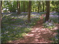
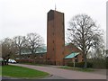
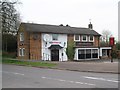
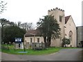
Photos of Sherrards Ward
Area Information
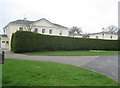
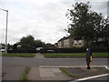
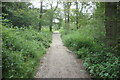
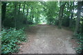
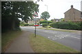
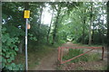
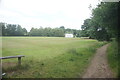
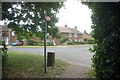
Sherrards Ward sits as a distinct district within Welwyn Hatfield Borough Council in Hertfordshire, covering exactly 3.1 km². You will find a population of 1,474 residents living across a compact borough unitary ward. The area is located in the eastern part of the Welwyn Hatfield zone, with coordinates placing it at 51.810555, -0.20848. This ward exists within a local government district with borough status that was formed on 1 April 1974 by merging three former districts: Hatfield Rural District, Welwyn Garden City Urban District, and Welwyn Rural District. Life here is defined by a deep connection to local heritage rather than modern sprawl. The ward takes its name from Sherrards mansion, a Victorian residence built circa 1861–1865 on the gates of Digswell Hill. The property has a notable 150-year history, having housed wealthy families like journalist William Henry Wills before becoming a training facility for the Spastics Society from 1956 to 1989. In 1997, the mansion was extended and converted into five separate houses. Today, the ward remains an electoral ward where the past visibly shapes the neighbourhood. Living in Sherrards Ward means you are in a location that preserves significant historical architecture while functioning as a practical part of the wider Welwyn Garden City community. The area offers a tight-knit environment where residents benefit from the legacy of properties that predate the town's formal establishment. Digswell Hill marks the boundary where this ward meets neighbouring areas, providing a clear geographical identity for those who call this space home.
- Area Type
- District Borough Unitary Ward
- Area Size
- 3.1 km²
- Population
- 1474
- Population Density
- 480 people/km²
Demographics
The community in Sherrards Ward has a clear demographic profile characterised by an older population and high levels of home ownership. The median age for residents is 70, making this one of the oldest wards in the region. In terms of household composition and accommodation type, the data records the total figures without breaking down specific age brackets for these categories. Despite the absence of granular breakdowns for household types, the overall population density stands at 480 people per square kilometre. This density figure is consistent with the ward's total population of 1,474 across its 3.1 km² area. Home ownership is significant here, with 69% of residents owning their homes outright. This indicates a settled community where long-term stability is common. The data does not provide specifics on ethnicity or religion, so those aspects of diversity remain unquantified in the available records. However, the ratio of owners to potential renters suggests a static demographic with minimal turnover. When evaluating the area for living, you are looking at a neighbourhood where the average resident is significantly older than the national average. The high ownership rate means you are likely to deal with owners who have a vested interest in the long-term value and condition of their properties. The population composition reflects a retirement or mature age demographic, which often correlates with quieter streets and a stable community structure. Living in Sherrards Ward offers an environment where the resident base is well-established.
Household Size
Accommodation Type
Tenure
Ethnic Group
Religion
Household Composition
Age
Household Deprivation
NS-SEC
Explore more demographic insights in this area
Go to Demographics tabPlanning
Planning Constraints
- Flood RiskPremium
- Ramsar Wetland SitesPremium
- Area of Outstanding Natural BeautyPremium
- Protected Nature ReservePremium
- Protected WoodlandPremium