Area Overview for Shernborne
Photos of Shernborne
Area Information
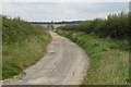
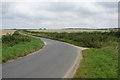
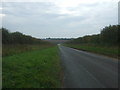
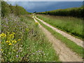
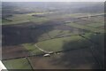
Shernborne is a small civil parish covering an area of just 5.6 km². This compact size defines daily life, creating a setting where distances are short and the community feels intimate. Living in Shernborne offers a straightforward environment without the complexity of larger urban districts. The area serves as a quiet residential parish where the local character remains distinct. You will find a place where the pace of life is measured and the surroundings are manageable on foot. This simplicity appeals to those seeking a settled home life away from the noise of larger towns. The location functions primarily as a residential zone with some working-age population present. It sits within the Surrey border region, providing a backdrop of established countryside and green spaces. Homes in Shernborne offer a sense of stability for residents who value local knowledge and quiet streets. The parish structure ensures that local governance remains focused on the specific needs of a small demographic. You can expect a landscape dominated by private gardens and homes rather than commercial strips. This focus on residential use means the environment is designed for living rather than commuting. Daily routines in Shernborne revolve around local amenities that are easily accessible. The small footprint means you can navigate the area without relying heavily on vehicles for short journeys. The community operates on a friendly, neighbourly basis that you might not find in denser populations. Buying a home here means joining a closed-knit group where local history and tradition matter. The parish provides a sheltered backdrop for life, emphasising peace and residential consistency.
- Area Type
- Parish
- Area Size
- 5.6 km²
- Population
- Not available
- Population Density
- Not available
Demographics
The demographic profile of Shernborne reveals a community with a significant focus on older residents. The median age in the parish stands at 70 years. This figure indicates that a large proportion of the population belongs to the retirement age bracket. When you look at the age ranges, total coverage shows that adult life dominates the neighbourhood more than childhood play. You are likely to find quiet streets and gardens that cater to established residents rather than families moving in with young children every few years. Sixty-nine per cent of households in Shernborne own their homes. This high ownership rate suggests a stable, root-set population with long-term ties to the parish. The remaining thirty-one per cent comprises other household compositions, including those who rent or share properties. Because so many people own their accommodation, the community has invested deeply in its surroundings over decades. This stability creates an environment where neighbours know each other well and maintenance of the parish is shared responsibility. Household composition data confirms that the area is not designed for transient living. You will encounter fewer young professionals or students compared to a university town. The demographic structure supports a retirement-focused lifestyle where social interaction happens through established clubs or local groups. If you consider living in Shernborne, you join a mature community that values peace and security. The low turnover of residents means you can build lasting friendships quickly rather than dealing with constant change. Every household contributes to a gentle, consistent atmosphere.
Household Size
Accommodation Type
Tenure
Ethnic Group
Religion
Household Composition
Age
Household Deprivation
NS-SEC
Explore more demographic insights in this area
Go to Demographics tabPlanning
Planning Constraints
- Flood RiskPremium
- Ramsar Wetland SitesPremium
- Area of Outstanding Natural BeautyPremium
- Protected Nature ReservePremium
- Protected WoodlandPremium
- Crime RiskPremium