Area Overview for Sheringham North Ward
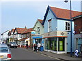
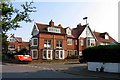
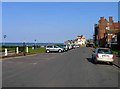
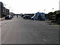
Photos of Sheringham North Ward
Area Information
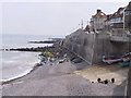
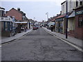
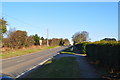
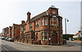
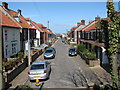
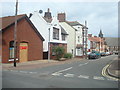
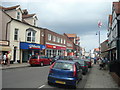
Living in Sheringham North Ward offers a compact coastal experience defined by its intimate scale and established character. This electoral ward sits within the North Norfolk District Council area of Eastern England, covering just 1.4 km² near the town of Sheringham. The location, situated at approximately 52.9437°N and 1.2096°E, positions residents close to the wider North Norfolk coast while maintaining a distinctly local identity. Most residents are housed within the borough unitary ward boundary, meaning daily life revolves around this specific concentration of land and community assets. The proximity to the town centre suggests easy access to local shops and services without venturing far from your home. Daily routines involve navigating a space small enough to feel like a close-knit neighbourhood yet large enough to support independent living. The area presents itself as a settled environment where the rhythm of coastal life intersects with the administrative structure of the North Norfolk region. For those seeking a bedroom community with coastal access, the location provides the necessary infrastructure of a ward while retaining the quietude of a limited footprint. This balance between accessibility and compactness makes it a practical choice for individuals prioritising proximity to the sea over sprawling suburban development.
- Area Type
- District Borough Unitary Ward
- Area Size
- 1.4 km²
- Population
- Not available
- Population Density
- Not available
Demographics
The population of Sheringham North Ward presents an exceptionally mature community profile. The median age across the ward stands at exactly 70 years, indicating that the backbone of the population consists of older adults. While the data indicates the total population age range, the specific concentration around the 70-year mark defines the social texture of the area. A significant 65% of households in Sheringham North Ward are owner-occupied, reflecting a high level of local stability and long-term residency. This ownership figure suggests that many families have remained in their properties for extended periods. The ward does not feature significant coverage of protected resources such as Ramsar wetland sites or protected nature reserves, focusing instead on standard residential use. Area of Outstanding Natural Beauty designation affects a portion of the land with a score of 31.58 out of 100, indicating some planning constraints related to landscape preservation. Community diversity metrics are recorded in the total household composition data, showing the demographic spread across the ward. For buyers seeking a community defined by longevity and ownership rather than transient renting, Sheringham North Ward fits the description precisely. The aging population may mean fewer young families with urgent mobility needs, creating a predictable and quiet living environment.
Household Size
Accommodation Type
Tenure
Ethnic Group
Religion
Household Composition
Age
Household Deprivation
NS-SEC
Explore more demographic insights in this area
Go to Demographics tabPlanning
Planning Constraints
- Flood RiskPremium
- Ramsar Wetland SitesPremium
- Area of Outstanding Natural BeautyPremium
- Protected Nature ReservePremium
- Protected WoodlandPremium
- Crime RiskPremium