Area Overview for Sheringham
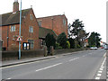
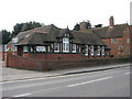
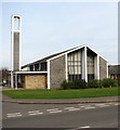
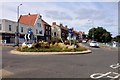
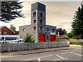
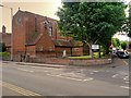
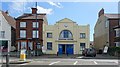
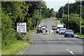
Photos of Sheringham
Area Information
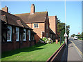
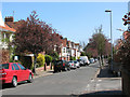
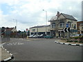
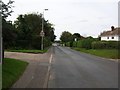
Sheringham is a small built-up area in England, covering 2.6 km², with a population skewed toward older residents, as the median age is 70. This makes it a community with a distinct demographic profile, where daily life is shaped by a mature population. The area is well-served by local amenities, including five retail outlets such as Tesco, Budgens, and Sainsburys, which cater to everyday needs. Proximity to rail stations like Sheringham and Cromer ensures connectivity to nearby towns, while metro stops at Weybourne and Holt provide access to coastal and inland routes. The area’s compact size means residents can access shops, schools, and transport hubs without long commutes. With 72% of homes owned outright, Sheringham reflects a stable housing market, though its character is defined by its older demographic and the mix of local and independent schools. Living here offers a blend of practicality and quiet community life, ideal for those seeking a low-maintenance, established environment.
- Area Type
- Built Up Area 250
- Area Size
- 2.6 km²
- Population
- Not available
- Population Density
- Not available
Sheringham’s lifestyle is shaped by its proximity to essential amenities. Five retail outlets, including Tesco, Budgens, and Sainsburys, provide convenient access to groceries and daily necessities. The area’s rail stations, such as Sheringham and Cromer, connect residents to nearby towns, while metro stops at Weybourne and Holt offer routes to coastal and inland destinations. For leisure, the surrounding areas include Weybourne and Holt, which may host local attractions or recreational spaces. The mix of shops, transport hubs, and nearby towns ensures a balance between convenience and community. While the data does not specify parks or dining options, the presence of multiple retail and transport points suggests a functional lifestyle, where residents can meet both practical and social needs without long journeys.
Amenities
Schools
Sheringham offers a range of educational options, including Sheringham Community Primary School, which holds a “Good” Ofsted rating. Nearby, Sheringham High School and Sixth Form Centre serves secondary education, while Sheringham Woodfields School caters to special needs. Independent schools such as Hilbre School provide alternative educational pathways. The presence of both state and independent schools gives families flexibility, whether they seek mainstream education or specialist support. The “Good” rating at Sheringham Community Primary School indicates a reliable foundation for younger children, while the academy status of Sheringham High School suggests a focus on academic performance. Families with children will find a mix of school types, ensuring options to suit different priorities, from traditional state education to independent alternatives.
| Rank | A + A* % | School | Type | Entry gender | Ages |
|---|---|---|---|---|---|
| 1 | N/A | Sheringham Community Primary School | primary | N/A | N/A |
| 2 | N/A | Sheringham High School and Sixth Form Centre | primary | N/A | N/A |
| 3 | N/A | Sheringham Woodfields School | special | N/A | N/A |
| 4 | N/A | Hilbre School | independent | N/A | N/A |
| 5 | N/A | Sheringham High School | academy | N/A | N/A |
Explore more schools in this area
Go to Schools tabDemographics
Sheringham’s population has a median age of 70, indicating a community dominated by older residents. The most common age range is listed as “Total,” suggesting data aggregation rather than specific groupings. Home ownership is high, with 72% of properties owned by residents, reflecting a stable, long-term population. The data does not specify household composition or accommodation types, but the overall figures suggest a predominantly owner-occupied area with a focus on single-person or couple households. The predominant ethnic group and religion are listed as “Total,” meaning no breakdown is available. This lack of detail does not detract from the area’s practical appeal, as the high home ownership rate and mature demographic suggest a low turnover of residents. For quality of life, the older population may prioritize accessibility and community services, which are evident in the area’s amenities and transport links.
Household Size
Accommodation Type
Tenure
Ethnic Group
Religion
Household Composition
Age
Household Deprivation
NS-SEC
Explore more demographic insights in this area
Go to Demographics tabPlanning
Planning Constraints
- Crime RiskLocked