Area Overview for Shenfield Ward
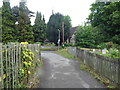
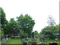
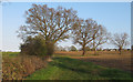
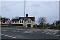
Photos of Shenfield Ward
Area Information
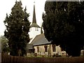
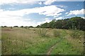
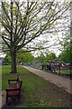
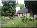
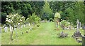
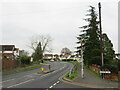
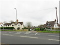
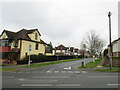
Shenfield Ward is a distinct suburban district within the Borough of Brentwood, covering just over 6.8 square kilometres. The area lies approximately 27 miles from central London and operates as a significant commuter hub within the wider London commuter belt. Situated about one mile north-east of Brentwood town centre, Shenfield formed part of an ancient parish that developed along the historic A1023 Roman road connecting London and Colchester. The local character is defined by its role as a dormitory town serving residents who commute to London, Romford, and Basildon. Historical roots run deep here, with the area's name originating from the Anglo-Saxon *Chenefield*, meaning *good lands*. The modern community benefits from enhanced transport links, including the Elizabeth line, which positions Shenfield as an interchange on the Great Eastern Main Line. Daily life blends suburban convenience with access to nearby countryside, anchored by a busy high street and several notable landmarks. You will find your daily needs met by a modest yet active shopping area, the Church of St Mary the Virgin, and recreational facilities such as the Courage playing fields on Chelmsford Road. This locality remains a popular choice for families seeking a balance of residential peace and connectivity to major employment centres.
- Area Type
- District Borough Unitary Ward
- Area Size
- 6.8 km²
- Population
- Not available
- Population Density
- Not available
Demographics
The community profile of Shenfield Ward reflects a mature and established neighbourhood, with a median age of 70. You can expect a settlement dominated by older generations rather than young families or students. The prevailing household composition and accommodation types are not detailed in the available records, though the extreme age figure suggests a significant portion of the population consists of retirees. Home ownership stands at 84 per cent, confirming that this is overwhelmingly an owner-occupied area where residents have long-term stakes in their properties. The population is not described as ethnically diverse in the provided data, and specific religious statistics remain undocumented. Despite the lack of granular diversity data, the high median age typically indicates a stable demographic with lower population turnover. This demographic structure supports a quiet residential atmosphere rather than a bustling youth culture. The affinity for home ownership reinforces the stability of the local community, creating an environment where property values generally reflect investment rather than speculation. Families drawn to the area are typically those with older children or empty nesters seeking a settled life away from the city centre.
Household Size
Accommodation Type
Tenure
Ethnic Group
Religion
Household Composition
Age
Household Deprivation
NS-SEC
Explore more demographic insights in this area
Go to Demographics tabPlanning
Planning Constraints
- Flood RiskPremium
- Ramsar Wetland SitesPremium
- Area of Outstanding Natural BeautyPremium
- Protected Nature ReservePremium
- Protected WoodlandPremium
- Crime RiskPremium