Area Overview for Shelford Ward
Photos of Shelford Ward
Area Information
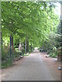
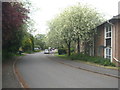
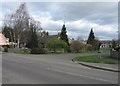
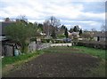
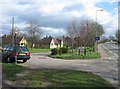
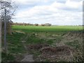
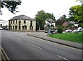
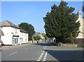
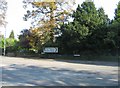
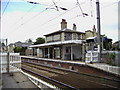
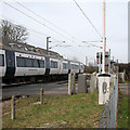
Shelford Ward forms an electoral district within South Cambridgeshire, incorporating the distinct parishes of Great Shelford, Little Shelford, and Stapleford. You will find this area situated approximately four miles south of Cambridge, positioned in eastern England with coordinates centreing near 52.1503°N. The ward covers a land area of 21.1 square kilometres, a relatively compact stretch of territory that manages a population of 1,741 people. This density results in roughly 1,335 people per square kilometre, suggesting a closely knit community rather than a sprawling sprawl. Great Shelford anchors the location, sitting close to the River Cam and just off the A1301 road. The existence of a designated Conservation Area protects significant features such as St Mary's Church, Manor House, and Shelford Ponds. Homebuyers looking for homes in this ward will encounter a landscape shaped by its history as a commuter village and its origins in Anglo-Saxon settlements. The ward does not contain any Ramsar wetland sites, Areas of Outstanding Natural Beauty, or protected nature reserves, meaning planning constraints are minimal beyond the conservation boundary. When considering living in Shelford Ward, you are looking at a specific, well-defined neighbourhood with historical roots and clear administrative boundaries.
- Area Type
- District Borough Unitary Ward
- Area Size
- 21.1 km²
- Population
- 1741
- Population Density
- 1335 people/km²
Demographics
The social fabric of Shelford Ward centres on an older demographic profile. The median age for residents reaches seventy years, marking a stark contrast to many other contemporary UK districts. This age statistic suggests a community where younger households are relatively rare compared to seniors. You will encounter a population where individuals range across various age groups, but the central tendency remains firmly in the later decades. Home ownership stands as the dominant tenure option, with seventy per cent of residents owning their properties outright or with a mortgage. This high rate indicates a stable, settled population rather than a dynamic rental market. The remaining thirty per cent of households likely comprise tenants or those in shared ownership arrangements. The data for household composition, predominant ethnic groups, and religious adherence does not provide specific breakdowns in the available records. Consequently, any discussion on diversity or family structures relies on the broader age demographics alone. The area supports a total accommodation type profile that aligns with this senior and owner-heavy demographic. Understanding who lives here requires acknowledging that the twenty-one-point-one square kilometre area serves primarily those seeking retirement or long-term stability rather than young professionals.
Household Size
Accommodation Type
Tenure
Ethnic Group
Religion
Household Composition
Age
Household Deprivation
NS-SEC
Explore more demographic insights in this area
Go to Demographics tabPlanning
Planning Constraints
- Flood RiskPremium
- Ramsar Wetland SitesPremium
- Area of Outstanding Natural BeautyPremium
- Protected Nature ReservePremium
- Protected WoodlandPremium
- Crime RiskPremium