Area Overview for SG9 9EQ
Photos of SG9 9EQ
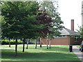
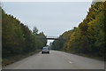

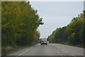
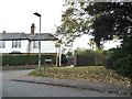
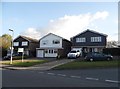
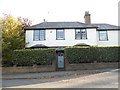
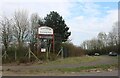
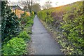
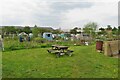
20 photos from this area
Area Information
Key information about the SG9 9EQ including its size, population, and administrative classification.
- Area Type
- Postcode
- Area Size
- 2.2 hectares
- Population
- 2140
- Population Density
- 4185 people/km²
House Prices in SG9 9EQ
34
Properties
£272,968
Average Sold Price
£63,500
Lowest Price
£517,500
Highest Price
Showing 34 properties
| Address | Type | Beds | Baths | Last Sale Price | Last Sale Date | |
|---|---|---|---|---|---|---|
| The Meadows, 40A Greenways, Buntingford, SG9 9EQ | Detached | 3 | 2 | £517,500 | Mar 2025 | |
| 10 Greenways, Buntingford, SG9 9EQ | house | - | - | £300,000 | Sep 2023 | |
| 30 Greenways, Buntingford, SG9 9EQ | house | - | - | £396,000 | Aug 2022 | |
| 32 Greenways, Buntingford, SG9 9EQ | Semi-detached | 3 | - | £370,000 | Apr 2021 | |
| 12 Greenways, Buntingford, SG9 9EQ | Semi-detached | 5 | 1 | £385,000 | Nov 2018 | |
| 44 Greenways, Buntingford, SG9 9EQ | Semi-detached | 3 | 1 | £373,000 | Sep 2018 | |
| 40 Greenways, Buntingford, SG9 9EQ | Terraced | 4 | - | £275,000 | Aug 2012 | |
| 50 Greenways, Buntingford, SG9 9EQ | house | 3 | - | £250,000 | Jan 2011 | |
| 58 Greenways, Buntingford, SG9 9EQ | house | - | - | £244,000 | Nov 2010 | |
| 14 Greenways, Buntingford, SG9 9EQ | Semi-detached | 4 | 1 | £220,000 | Apr 2007 |
Page 1 of 4
Energy Efficiency in SG9 9EQ
Amenities
Schools
| Rank | School | Type | Entry gender | Ages |
|---|
Explore more schools in this area
Go to Schools tabDemographics
Household Size
Family (3-5 people)
most common
Accommodation Type
Houses
most common
Tenure
66
majority
Ethnic Group
White
most common
Religion
N/A
most common
Household Composition
N/A
most common
Age
47
median
Adults (30-64 years)
most common
Household Deprivation
N/A
with no deprivation
NS-SEC
31
in Lower managerial occupations
Explore more demographic insights in this area
Go to Demographics tabPlanning
Planning Constraints
- Flood RiskPremium
- Ramsar Wetland SitesPremium
- Area of Outstanding Natural BeautyPremium
- Protected Nature ReservePremium
- Protected WoodlandPremium