Area Overview for SG9 0SP
Photos of SG9 0SP


Area Information
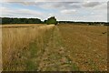
Postcode SG9 0SP defines a specific residential cluster covering 81.9 hectares in England. This small area accommodates a total population of 2,066 people, resulting in a low density of 33 people per square kilometre. Living in SG9 0SP means residing in a relatively spacious environment where residents have significant room around their properties. The area functions as a quiet suburban pocket rather than a busy town centre. You will find a neighbourhood character built around detached and semi-detached housing rather than high-density blocks. Daily life here revolves around proximity to estates like the ones near Baldock and Buntingford. The location offers a practical distance from larger towns while maintaining a sense of isolation from saturated urban centres. Commuters often utilise nearby rail links to reach central London or other business hubs. The spatial layout supports a lifestyle where residents value outdoor space and reduced noise levels. This specific postcode serves as a gateway for those seeking a calm domestic setting without the full expense of larger commuter belts. Weaving in local history, the area has evolved into a stable residential zone favoured by households prioritising space and quiet over immediate access to nightlife. The sheer size of the cluster relative to its population ensures that streets retain a tucked-away feel even if you are part of a growing family.
- Area Type
- Postcode
- Area Size
- 81.9 hectares
- Population
- 2066
- Population Density
- 33 people/km²
Homes in SG9 0SP are overwhelmingly owner-occupied, with 69 per cent of residents holding the title deeds to their properties. The accommodation type data confirms that the housing stock primarily consists of houses rather than flats or apartments. This structure defines the property market as one geared towards families and retirees who have stayed put over decades. You are unlikely to encounter a high volume of short-term tenancies or student housing within this specific cluster. The high ownership percentage suggests that seller motivation may vary depending on how long individuals have lived in their homes. Buyers looking at this area should expect to compete with locals who have deep roots in the community. Property prices will naturally reflect the cost of building land for spacious houses rather than high-density developments. The market operates on a slower cycle where negotiations often depend on the readiness of local agents and the specific condition of each house. Since the area covers 81.9 hectares, there is enough space for occasional new builds to integrate without overwhelming the existing character. Families relocating here typically value the sectional nature of the homes that match their need for gardens and rear boundaries. The scarcity of rental properties means that purchasing a home is the standard route to securing a residence.
House Prices in SG9 0SP
Showing 6 properties
| Address | Type | Beds | Baths | Last Sale Price | Last Sale Date | |
|---|---|---|---|---|---|---|
| Augusty House, Southern Green, Rushden, SG9 0SP | house | - | - | £800,000 | Jun 2020 | |
| Youngloves Farmhouse, Southern Green, Rushden, SG9 0SP | house | 5 | - | £1,268,000 | Dec 2019 | |
| Youngloves Cottage, Southern Green, Rushden, SG9 0SP | house | - | - | £715,000 | Sep 2010 | |
| Parknasilla, Southern Green, Rushden, SG9 0SP | Detached | 5 | 2 | - | - | |
| West Barn, Southern Green, Rushden, SG9 0SP | Semi-detached | - | - | - | - | |
| North Barn, Southern Green, Rushden, SG9 0SP | Semi-detached | - | - | - | - |
Energy Efficiency in SG9 0SP
Residents of SG9 0SP enjoy practical access to retail and rail amenities within easy reach. Sainsburys Buntingford and Budgens Buntingford serve the grocery needs of locals living in the postcode. You can also find Budgens Walkern to compare prices or stock ranges. These three specific supermarkets form the core of the retail experience without requiring a trip into a large town centre. Three railway stations operate nearby to facilitate regional travel: Baldock Railway Station, Ashwell & Morden Railway Station, and Letchworth Railway Station. These stations connect you to broader transport networks efficiently. While the area itself contains no listed cinemas, parks, or leisure centres within the immediate amenity data, the nearby clusters provide sufficient variety. Shopping trips are mostly limited to capsule retail outlets like butchers, bakers, and smaller off-licenses that accompany the larger chains. Living in SG9 0SP means prioritising convenience over extensive entertainment options. You might drive five minutes for a coffee or cinema ticket rather than seeking them within walking distance. The current landscape of amenities prioritises essential goods and transport links above immersive leisure facilities. This functional approach suits families who value time efficiency over urban exploration.
Amenities
Schools
Families living in SG9 0SP have access to two named primary schools within practical reach. Weston Primary & Nursery School holds an Ofsted rating of good, offering a solid educational option for young children in the area. Sandon Junior Mixed and Infant School carries an Ofsted rating of satisfactory, providing an alternative route for primary education. Both institutions are situated near the larger settlements that support the SG9 0SP cluster. This mix of schools suggests a choice between a higher-rated option and a nearby satisfactory institution for parents with different nurturing philosophies. You do not have a secondary school listed in the immediate vicinity within the provided data, meaning older children likely travel to neighbouring towns for high school education. The presence of a nursery facility indicates support for infants and toddlers alongside older pupils. Parents should consider travel times carefully when selecting between these two primary providers. The variety in Ofsted ratings means you must weigh the prestige of a good rating against the proximity of a satisfactory one. Neither school is an academy or free school based on the available titles, but both operate within the state system. The localized nature of these schools reinforces the village community feel of SG9 0SP.
| Rank | School | Type | Entry gender | Ages |
|---|
Explore more schools in this area
Go to Schools tabDemographics
The community within SG9 0SP reflects a settled demographic with a median age of 47 years. Most residents fall into the adult bracket between 30 and 64 years old, indicating a population that has lived in the area for some time. With 69 per cent of households owning their homes, this postcode is predominantly an owner-occupied sector rather than a rental market. The majority of accommodation consists of houses, which aligns with the preferences of this established age group. While data on current deprivation indices is not included in the provided statistics, the high home ownership rate often correlates with long-term community stability. The predominant ethnic group in SG9 0SP is White, mirroring the broader demographic trends of many established Hertfordshire villages. You will find a demographic profile typical of retirement villages or families with older children moving on to semi-retirement. The population density of 33 people per square kilometre suggests that neighbours likely know each other well. Social interactions probably occur in local pubs or community halls rather than on crowded streets. This demographic structure creates a neighbourhood where fairness and tradition often guide local decision-making. Residents in this age group typically seek stability and safety above all else when choosing their home.
Household Size
Accommodation Type
Tenure
Ethnic Group
Religion
Household Composition
Age
Household Deprivation
NS-SEC
Explore more demographic insights in this area
Go to Demographics tabPlanning
Planning Constraints
- Flood RiskPremium
- Ramsar Wetland SitesPremium
- Area of Outstanding Natural BeautyPremium
- Protected Nature ReservePremium
- Protected WoodlandPremium