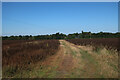
Area Overview for SG9 0NN
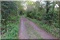
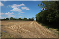
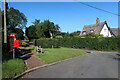
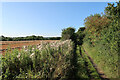
Photos of SG9 0NN


Area Information
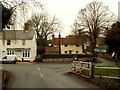
Living in SG9 0NN offers a distinctly quiet residential experience within the UK countryside. This specific postcode covers a small cluster of properties spanning 9,384 square metres. The area holds a total population of 1,387 residents, creating a low-density environment that feels removed from the intensity of larger towns. You will find yourself surrounded by a close-knit community where daily life moves at a slower pace. The setting is defined by its residential nature rather than commercial activity, making it suitable for those seeking peace and space. Residents here value the calm atmosphere that characterises this specific corner of Hertfordshire. The limited area size means streets are short and direct, reducing travel times between homes. While the population is moderate, the low density ensures that noise levels remain low throughout the day. This demographic profile suggests a neighbourhood built for stability and long-term living rather than transient rental turnover. If you are looking for a home in SG9 0NN, you are entering an established pocket of the sunken gardens that supports a traditional, settled way of life. The area provides a solid foundation for family living without the clutter of urban sprawl.
- Area Type
- Postcode
- Area Size
- 9384 m²
- Population
- 1387
- Population Density
- 43 people/km²
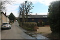
The property market in SG9 0NN is characterised by a heavy emphasis on house ownership. With 74% of the population owning their homes, the area functions primarily as a stock of owner-occupied properties rather than a landlord rental estate. This ownership model suggests that sellers here are often motivated by equity rather than rental yields. The accommodation type is exclusively houses, which dictates the style of architecture and the potential value of each plot. You will not encounter high-rise flats or purpose-built rental blocks within this postcode boundary. Instead, you find traditional residential housing that caters to families seeking privacy and space. This lack of mixed-quality housing stock means that property values tend to reflect the condition and size of individual houses rather than the variety of unit types. For anyone looking at homes in SG9 0NN, the market offers consistency. Buyers deal with single-family dwellings where boundaries are clear and social interactions revolve around street maintenance rather than block management. The high ownership rate indicates that residents take pride in maintaining their properties, which often preserves structural integrity better than heavily rented areas. This market dynamic benefits buyers looking for a stable investment in a residential cluster.
House Prices in SG9 0NN
Showing 3 properties
| Address | Type | Beds | Baths | Last Sale Price | Last Sale Date | |
|---|---|---|---|---|---|---|
| Maidshot, Horseshoe Hill, Great Hormead, SG9 0NN | house | 4 | - | £520,000 | Aug 2011 | |
| Craven House, Horseshoe Hill, Great Hormead, SG9 0NN | Detached | - | - | - | - | |
| Rosebank, Horseshoe Hill, Great Hormead, SG9 0NN | Detached | - | - | - | - |
Energy Efficiency in SG9 0NN
Daily living in SG9 0NN relies on the small cluster of amenities located within practical walking or short driving distance. Within the retail category, four key venues serve the local population. You can find food stores at Co-op Buntingford, Sainsburys Buntingford, and Budgens Buntingford. These three supermarkets alongside the budget-friendly option provide all weekly grocery requirements without the need for long journeys to town centres. This concentration of shopping outlets means you rarely run out of essentials while at home in SG9 0NN. The proximity to these named stores supports a self-sufficient lifestyle where residents can manage household shopping efficiently. Public transport options are not explicitly detailed in this specific data set, so car access remains the primary method for reaching broader business districts or leisure destinations further afield. The presence of Co-op Buntingford and Sainsburys Buntingford indicates that the immediate area is economically active enough to support trade. Residents appreciate the ability to stock up large quantities of food or pick up prescription medication from Budgens Buntingford without venturing far. This arrangement is ideal for the 1,387 residents who value convenience and independence from the congestion of major roads.
Amenities
Schools
Schooling for children in SG9 0NN is supported by two nearby educational institutions, both rated as Good by Ofsted. Anstey First School serves as a local primary option with a Good rating. It provides education for younger pupils in the immediate vicinity. Hormead Church of England (VA) First School is the second primary school in the vicinity, also holding a Good rating. This school caters to families seeking a faith-based education within the local community. The presence of these two primary schools means that most children in the area enter the education system locally before potentially moving to secondary institutions further away in Buntingford or Stevenage. Having schools with Good ratings allows parents to rely on a solid educational foundation without needing to commute for primary schooling. Both Anstey First School and Hormead Church of England (VA) First School offer a curriculum that meets national standards. The mix of denominational and general primary education provides choice for different family values. Residents can feel confident that their children will have access to quality education close to their homes in SG9 0NN. This local provision reduces transport costs for parents and integrates children into the local neighbourhood fabric early on.
| Rank | School | Type | Entry gender | Ages |
|---|
Explore more schools in this area
Go to Schools tabDemographics
The community in SG9 0NN is defined by stability and maturity. The median age of residents stands at 47 years, reflecting a strong presence of working families and retirees. The most common age range falls within adults aged between 30 and 64 years, which aligns with the area's family-oriented character. This age profile indicates a population that has settled down, away from the volatility of student quarters or young professional hubs. Home ownership is the dominant sentiment, with 74% of households owning their property outright or with a mortgage. This high rate of ownership contrasts sharply with typical rental markets found near city centres. The predominant accommodation type consists of houses, which fits the demographic desire for private garden space and domestic tranquility. The area is also ethnically diverse, with the White ethnic group being the predominant demographic. These figures paint a picture of a neighbourhood where families have stakes in their homes. The combination of older residents and mounted homeowners creates an environment where neighbours know each other over generations. This stability means you are buying into a community, not just a address.
Household Size
Accommodation Type
Tenure
Ethnic Group
Religion
Household Composition
Age
Household Deprivation
NS-SEC
Explore more demographic insights in this area
Go to Demographics tabPlanning
Planning Constraints
- Flood RiskPremium
- Ramsar Wetland SitesPremium
- Area of Outstanding Natural BeautyPremium
- Protected Nature ReservePremium
- Protected WoodlandPremium