Area Overview for SG9 0DP
Photos of SG9 0DP

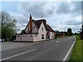
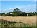
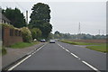


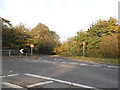

Area Information
SG9 0DP is a compact residential cluster covering 20 hectares. The area holds a population of 1633 residents, averaging 115 people per square kilometre. You will find this postcode primarily in the countryside sector of the SG9 postcode district, near Buntingford. The setting is small and specialised rather than a large urban sprawl. Most inhabitants live in detached or semi-detached houses within close quarters. This cluster offers a quiet domestic environment for families and older residents. You experience a neighbourhood that prioritises space over density. Daily life involves a focus on privacy and access to the surrounding landscape. The small scale means you can easily walk to key landmarks if they are immediately adjacent. This residential pocket provides a distinct experience compared to larger towns. You benefit from lower construction noise and a slower pace of life. The area serves as a practical home for those seeking a rural location without complete isolation. SG9 0DP remains a stable community with firmly established patterns of living. The low density减轻了 pressure on local services and shared spaces. A home here places you in a setting designed for long-term settlement. You gain immediate access to a tight-knit group of neighbours who share similar property types. This specific postcode represents a contained and manageable environment for home ownership.
- Area Type
- Postcode
- Area Size
- 20.0 hectares
- Population
- 1633
- Population Density
- 115 people/km²
The housing market in SG9 0DP is defined by strong home ownership. You will encounter a landscape where 81% of residents own their dwellings. This high figure indicates that the property market is not driven by short-term rentals or student accommodation. Instead, it caters to families and retirees seeking permanent residence. The accommodation type is strictly houses, removing flats and apartments from the equation entirely. This data points to a local estate dominated by detached and semi-detached homes. You will find a scarcity of terraced properties or purpose-built blocks. The layout supports larger gardens and private outdoor spaces typical of UK homes in this sector. The market functions as a classic owner-occupied environment rather than a buy-to-let hub. Buyers looking for investment through rental yields may struggle here due to the low tenant turnover. The environment appeals to those who value a fixed mortgage term and long-term stability. The property stock reflects a tenure where owners have invested deeply in their schools and neighbourhood management. You cannot find shared ownership schemes or pebble dash tower blocks in this cluster. The housing stock remains consistent with the needs of the local age profile. This makes SG9 0DP an ideal location for first-time buyers entering the market or downsizers replacing larger properties. The uniformity of the homes creates a cohesive visual character across the 20-hectare area.
House Prices in SG9 0DP
Showing 5 properties
| Address | Type | Beds | Baths | Last Sale Price | Last Sale Date | |
|---|---|---|---|---|---|---|
| 1, Chipping Court, Chipping Hall Barns, A 10 Through Chipping Village, Chipping, SG9 0DP | house | 4 | 2 | - | - | |
| 4, The Granary, Chipping Hall Barns, A 10 Through Chipping Village, Chipping, SG9 0DP | Semi-detached | 4 | 2 | - | - | |
| 5, The Old Stables, Chipping Hall Barns, A 10 Through Chipping Village, Chipping, SG9 0DP | house | 4 | 3 | - | - | |
| 3, The Hay Loft, Chipping Hall Barns, A 10 Through Chipping Village, Chipping, SG9 0DP | Semi-detached | 5 | 3 | - | - | |
| 2, The Old Forge, Chipping Hall Barns, A 10 Through Chipping Village, Chipping, SG9 0DP | Semi-detached | 5 | 2 | - | - |
Energy Efficiency in SG9 0DP
Living in SG9 0DP offers immediate access to essential retail and leisure options in nearby towns. You will find five major retail outlets within practical reach. Notable stores include Sainsburys Buntingford, Budgens Buntingford, and Co-op Buntingford. These supermarkets provide the daily groceries you need without planning a full-day trip to a city centre. You can rely on these chains for your weekly shopping needs across different budget ranges. Transport links extend your daily lifestyle to include railway travel. Two train stations serve the area: Ashwell & Morden Railway Station and Royston Railway Station. These hubs allow you to access Buntingford quickly if you require specialized shopping services. The proximity to Buntingford means you have more than just essential retail. You can reach wider cultural and leisure amenities that are not listed directly within the single postcode cluster. Your daily routine benefits from this扎实层次的 local provision. You do not need to drive far to stock your pantry or attend film screenings. The presence of multiple retailers ensures availability regardless of specific chain preferences. You gain convenience through the density of these local trades. This setup reinforces the area\u2019s appeal to residents who value self-sufficiency but still require good transport connections. The blend of independent convenience stores like the Co-op and large supermarkets like Sainsburys creates a balanced local economy.
Amenities
Schools
You have access to several educational institutions near SG9 0DP, though flexibility is required for primary choices. Layston Church of England First School is a primary school located in the immediate vicinity. Its Ofsted rating is satisfactory, providing a baseline standard for early education. You must verify current capacity and catchment zones directly with the school administration. The data also lists Freman College twice under different classifications. One entry identifies it as a primary school without a specific Ofsted rating currently listed. You also find Freman College operating as an academy. This campus holds a good Ofsted rating, indicating a higher standard of performance. This dual listing suggests different year groups or structural divisions within the institution. For families looking at secondary education, they should expect to look beyond this specific cluster. The mix includes both Church of England faith-based provision and academy structures. This variety offers parents the choice between religious and secular schooling models. The educational options serve the local demographic well by providing primary education close to home. You will not find comprehensive secondary schools listed within the immediate data for this postcode. Families planning ahead for teenage years will need to utilise transport links to reach larger towns. The presence of a satisfactory-rated primary school supports the needs of the 30-64 age demographic. The good-rated academy provides a solid alternative for older children requiring secondary education.
| Rank | School | Type | Entry gender | Ages |
|---|
Explore more schools in this area
Go to Schools tabDemographics
The community in SG9 0DP features a predominantly older demographic. The median age stands at 47 years, indicating a mature population base. Most residents fall within the 30 to 64 years age range. This profile suggests the area attracts adults who have moved away from high-pressure city careers. You will notice a significant proportion of homeowners rather than renters. Exactly 81% of households are owner-occupied. This high ownership rate reflects stability and long-term financial commitment to the property. Families and retirees likely dominate the social fabric of this neighbourhood. The accommodation type is exclusively houses, offering spacious living arrangements suitable for established families. White ethnicity forms the predominant group in this residential cluster. You do not find the transient population common in student-friendly urban centres. Instead, the demographic structure remains rooted and consistent over time. This stability often creates a more predictable local environment for service providers and neighbours. The age distribution influences local leisure and activity options. Younger children are less common compared to other suburban areas. You will see a population that values ownership equity and property longevity. The single-dominant ethnicity and age bracket suggest a homogenous community feel. This demographic reality shapes how residents interact with local amenities and political representatives. You can expect a quiet, settled atmosphere driven by this specific cohort of adults.
Household Size
Accommodation Type
Tenure
Ethnic Group
Religion
Household Composition
Age
Household Deprivation
NS-SEC
Explore more demographic insights in this area
Go to Demographics tabPlanning
Planning Constraints
- Flood RiskPremium
- Ramsar Wetland SitesPremium
- Area of Outstanding Natural BeautyPremium
- Protected Nature ReservePremium
- Protected WoodlandPremium