Area Overview for SG8 8XJ
Photos of SG8 8XJ
Area Information
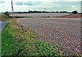
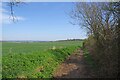
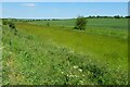
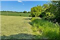
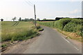
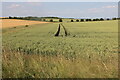
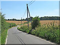
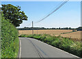
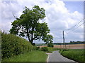
Living in SG8 8XJ offers a quiet residential experience within a small cluster that defines the local character. This specific postcode covers an area with a population of 1,563 people, resulting in a density of 46 people per square kilometre. The setting sits comfortably in the Uttlesford district of Essex, positioning residents just 5 miles from Saffron Walden and near the Cambridgeshire boundary. Historically, this region traces back to early landholdings mentioned in the Domesday Book, evolving from arable farming communities into the modern residential zones seen today. The landscape retains its rural roots, defined by light, chalky soils suitable for cereal crops and bordered by small brooks draining towards the River Cam. For someone seeking a village life with access to the wider region, this location provides a stable environment where history meets contemporary living. The area avoids significant planning constraints such as protected wetlands or areas of outstanding natural beauty, allowing for straightforward development while maintaining its village identity.
- Area Type
- Postcode
- Area Size
- Not available
- Population
- 1563
- Population Density
- 46 people/km²
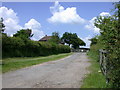
The housing market in SG8 8XJ is dominated by owner-occupied homes, distinguishing it from typical rental-heavy zones in urban centres. Seven out of every ten homes are owned by their occupants, creating a stable environment where long-term residents remain put. Houses constitute the primary accommodation type in this cluster, suiting the preference of buyers who seek detached or semi-detached properties over flats. This structure means the local property market is driven by retirees, established families, and professionals looking for stability rather than landlords seeking short-term lets. The low population density of 46 people per square kilometre reinforces the availability of space and garden areas, which command higher value in this segment. Buyers considering homes in SG8 8XJ should expect to purchase traditional house types within a compact residential zone that lacks the high-rise density found in city centres.
House Prices in SG8 8XJ
No properties found in this postcode.
Energy Efficiency in SG8 8XJ
Daily life in SG8 8XJ revolves around local amenities that are within practical reach of the residential cluster. Residents have immediate access to five retail options, including notable stops like M&S Whittlesford Cambridge BP, Co-op Melbourn, and Cook Saffron. For those requiring shopping, these outlets provide access to groceries, financial services, and basic household necessities without extensive travel into larger towns. Transport links are further strengthened by five railway stations nearby, specifically Great Chesterford Railway Station, Whittlesford Parkway Railway Station, and Audley End Railway Station. These stations facilitate travel to Saffron Walden, Cambridge, and London, offering flexibility for work or leisure. The area retains its village character, sheltered by historic features such as the Grade II* listed church of St Nicholas and the moated manor house known as Pigots. A local recreation ground provides space for cricket and football, catering to community sports and outdoor activities without the need to leave the parish boundaries.
Amenities
Schools
Families considering homes in SG8 8XJ have access to specific educational institutions that serve the local catchment. Chrishall Holy Trinity and St Nicholas CofE (Aided) Primary School and Pre-School operates as a primary institution nearby and holds an Ofsted rating of good. This rating indicates that the school meets the required standards for education and child welfare under current government inspections. As a Church of England Aided school, it provides a faith-based education within the local community framework. The proximity of this single named primary school simplifies decisions for parents looking for a place for their younger children to begin their education. There is no data listed for secondary schools or other educational facilities in the immediate vicinity of this specific postcode cluster, meaning the primary option remains the central reference point for local family needs.
| Rank | School | Type | Entry gender | Ages |
|---|
Explore more schools in this area
Go to Schools tabDemographics
The community character in SG8 8XJ is defined by a mature population and stable occupancy rates. The median age for residents is 47 years, indicating that the most common age group consists of adults between 30 and 64 years old. This demographic profile suggests a neighbourhood typical of families in later stages of raising children or older professionals settled in the area. Home ownership stands at 76%, reflecting a market where residents predominantly own their properties rather than rent. The majority of dwellings in this area are houses, which aligns with the ownership statistics and the historical growth of the parish. White residents make up the predominant ethnic group, matching the broader demographic trends of the Uttlesford district. With 1,563 people living across this low-density cluster, the social fabric relies on neighbours who are likely interconnected through long-term residence rather than transient mobility.
Household Size
Accommodation Type
Tenure
Ethnic Group
Religion
Household Composition
Age
Household Deprivation
NS-SEC
Explore more demographic insights in this area
Go to Demographics tabPlanning
Planning Constraints
- Flood RiskPremium
- Ramsar Wetland SitesPremium
- Area of Outstanding Natural BeautyPremium
- Protected Nature ReservePremium
- Protected WoodlandPremium